This year the Trans-African Hydro-Meteorological Observatory celebrates a decade in operation. Co-founder Nick van de Giesen explains how the project has progressed and reveals what he hopes the next 10 years will bring.
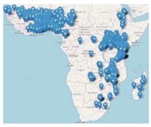
On June 4, 2024, the Trans-African Hydro-Meteorological Observatory (TAHMO) will celebrate its 10th anniversary in Nairobi, Kenya. What started out as an idea to use modern sensors and emerging telemetry is now an operation that maintains a network of more than 600 weather stations in more than 20 African countries. With over three billion datapoints, TAHMO has become the largest provider of African in-situ weather, water and climate data for national governments and researchers around the world. The key success factor has been the motivated and highly skilled team of engineers and technicians on the ground. A scalable IT system was also key to the growth over the past decade.
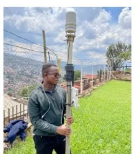
The present TAHMO network has been built through a variety of projects. It was jump-started by a generous grant from IBM that enabled the team to install 300 stations. After this, the team successfully applied for grants from different organizations. Many projects aimed to provide warnings about flooding or heavy weather, others to build information systems for agriculture. However, all projects come to an end and the current challenge is the continuous maintenance of the hardware and software systems when they do.
Collaboration is key
TAHMO envisioned a day when climate and hydrological processes could be monitored so robustly that a small team could manage an entire continent. There must be no moving parts, self-powered real-time telemetry, and all inconspicuous enough to avoid the interest of curious passers-by. Furthermore, thousands of stations needed to be economically constructed to be scientifically accurate, environmentally stable and easily maintained. We quickly realized that this was a problem that demanded more than novice instrument designers: we needed the best, most dynamic engineers in a company that could build and support the technology.
Therefore, a relationship with Meter Group was established. This developed into a full partnership with co-development and commitment to the long-term success of the project. TAHMO and Meter have now worked through four generations of sensor platforms, each more accurate, durable and easy to maintain than the last. The station has gone on to become a major product for Meter Group, which has sold the TAHMO-inspired station around the world to be used in scientific, agronomic and climatic studies.
TAHMO collaborates with many other companies as well, as a consumer of existing products and a co-developer of new methods, such as for optical stream gauging and for the use of GPS for environmental observation. Collaboration across the lines of academia, governmental offices and industry has also been a hallmark of the TAHMO project.
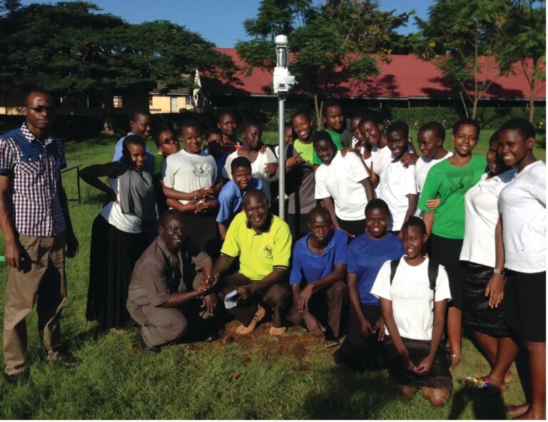
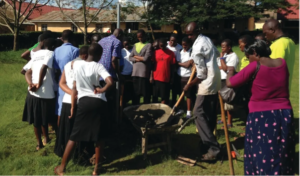
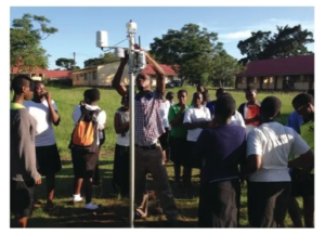
More than 90% of our weather stations have been placed at secondary schools, where they receive some social and physical protection. In return, the stations can be used in the curriculum; over the years, a rich set of teaching materials has been developed. Contact with the teachers is very important as small maintenance, especially simple cleaning, greatly reduces operational costs. Teacher engagement has been very successful in some cases but less so in many others. When experienced teachers move on and new teachers come in, it takes time and effort to build the same rapport.
From data to actionable information
TAHMO always works closely with government organizations, typically the hydromet services. In most cases, MoUs have been signed with the hydromet services of the host countries to ensure that data is available to government and science. From the beginning, the idea was that when data was used for commercial purposes, a small fee would be charged to maintain the network. It turned out that the market for raw meteorological data is very small indeed. On one side, people see data provision as a government task and insist on having access for free. More importantly, people would like to have actionable information and not just data. A smallholder farmer would be happy to learn that rain is expected tomorrow but could not care less about yesterday’s barometric pressure. There is a limited number of applications that can be served by near-real-time data. One, of course, would be the improvement of weather forecasts by a better description of the initial conditions and assimilation of measured variables. Such a forecast process is more involved than one might think, and we are only now starting small experiments in Ghana and Kenya.
An important application is index-based crop insurance. Such insurance has long been seen by economists as an important way to lift subsistence farmers into more productive and market-oriented cropping methods. Many insurance schemes have been tried but, in Africa, most have failed. A main hindrance has been the so-called basis risk, which is caused by the extreme spatial variability of convective rainfall. Satellite products are not reliable at field scale so farmers are not paid when they should be, and paid when there is no reason. This undermines trust and willingness to pay.
With a dense network of stations, in combination with satellite information, TAHMO can say with much higher reliability whether or not farms were hit by a drought. Equally important is that data is available within a day, so payment after a crop failure can be rapid, enabling farmers to resow within the same season. A pilot on germination insurance starts this year in northern Ghana.
A second application, and one that is the basis of many of our projects, concerns flood early warning systems (FEWS). With the United Nations Early Warnings for All initiative, we expect this only to increase. Clearly, FEWS are the responsibility of governments, but TAHMO can play an important supporting role. For urban flooding, one needs relatively dense observation networks for which fully fledged standard synoptic stations would be too costly, both financially and in terms of human resources.
So far, we have mainly been involved in the development of bespoke FEWS for large cities such as Dar es Salaam (Tanzania), Accra (Ghana) and Abidjan (Côte d’Ivoire). With the Kenya Meteorological Department (KMD), we are now working on a modular system that can also be cost-effective for smaller urban communities. About two-thirds of Africa’s urban population live in cities of less than 700,000 inhabitants. With standard parts and software integrations, KMD and other meteorological services will soon be able to also serve these communities.
IT innovations
TAHMO is an extremely frugal organization. Our income is very limited, and every cedi, shilling and kwacha needs to be stretched to the limit to ensure maximum output. An advanced data management system, which includes quality control, maintenance apps and asset management software, has helped keep our operational costs low. TAHMO has developed an advanced QA/QC system, where AI-based algorithms flag suspicious data that is then checked by our staff. Although some sensor failures are readily found, others are far from easy to detect. Probably the most important variable is rainfall, and it is very difficult to detect rapidly if a station is giving false negatives by not reporting rain that does fall. We compare values with nearby stations, climate and products based on satellite observations, but necessarily some time must pass before one can say with any likelihood that a station is indeed not reporting properly.
About three years ago, it became clear that we were somewhat over-stretched and that it was difficult to maintain the number of stations that we had. We saw a downward trend in completeness of the data. A program was started to analyze the logistics, failing mechanisms and possibilities for improved maintenance by hosts. New projects now aim more at network maintenance and less at expansion and we are seeing an upward trend, with the number of ‘golden standard stations’ increasing every month.
Outlook
Although TAHMO has been successful in the acquisition of projects and building an extensive network of partners, we see the need to innovate further, both technically and financially. From a financial point of view, subscription-based income will be needed to supplement project income. The simple fact that stations must be maintained after a project is finished necessitates this development.
Based on our experience – especially from projects funded by European Union grants, such as from the TWIGA and TEMBO Africa programs – FEWS, agricultural insurance and reservoir management are the most promising commercial applications of our data. The role of public-private partnerships in building public services, such as FEWS, has been acknowledged for some time and service-level agreements would be a simple way to join forces. Fintech and crop insurance have a deep need for in-situ weather data for climate de-risking and, given our cost-effectiveness, may very well cover maintenance costs in rural areas. Finally, hydropower reservoirs in Africa would be able to reduce spilling through timely hydrological forecasts. By 2026, we expect 20% of our income to come from subscriptions in these three sectors, so partnerships are essential.
“An advanced data management system, which includes quality control, maintenance apps and asset management software, has helped keep our operational costs low”
Because most people in TAHMO have engineering backgrounds, we are also looking forward to technical innovations, mainly in the fields of river level and discharge measurements. In a way, the ‘H’ in TAHMO has been somewhat underserved and we have mainly been using off-the-shelf solutions that are not always cost-effective, especially in terms of total cost of ownership and local human resources. In Ghana and Zambia, we work with industrial partners GReD, SEBA, Rainbow Sensing and Photrack on camera- and GNSS-based river observations that will drastically reduce total costs and ensure sustainable local embedding.
TAHMO started out with the somewhat simplistic ambition to build a network of 20,000 weather stations in Africa, a density comparable to that of Europe. After 10 years of cooperation, projects and interactions with many types of stakeholders, our ambition is now more nuanced. We want to do all we can to ensure that Africa’s weather, water and climate are monitored and that information creates value in society. Sometimes this will ask for our technical solutions, sometimes for simply sharing our experience to strengthen companies and government agencies.
This article originally appeared in the April 2024 issue of Meteorological Technology International. To view the magazine in full, click here.


