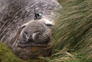
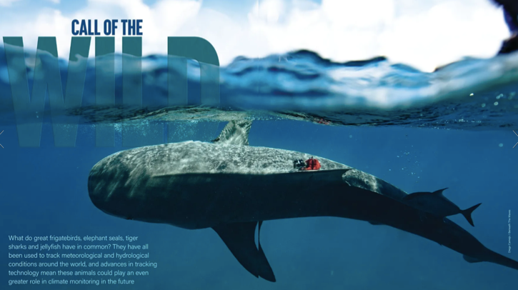
What do great frigatebirds, elephant seals, tiger sharks and jellyfish have in common? They have all been used to track meteorological and hydrological conditions around the world, and advances in tracking technology mean these animals could play an even greater role in climate monitoring in the future

Eight other animal species were tracked alongside the frigatebirds for the project. When Gilmour showed the tracking data collected from the birds to Ian Brosnan, a marine scientist at NASA’s Ames Research Center, Brosnan got excited about how else the data could be used.
Great frigatebirds have small bodies but large wingspans measuring up to 2.5m, which make them adept at riding warm tropical air currents with minimal effort. Rising on these air currents, the birds routinely fly to 2km in altitude, sometimes soaring to heights of 4km.
Brosnan suspected that during their sorties to high altitude the frigatebirds were traversing to the upper limits of the planetary boundary layer (PBL), the dynamic atmospheric layer that is closest to Earth. After cross-referencing the bird dataset with PBL altitude data for the same period, Brosnan and Gilmour were able to prove this hypothesis.
Since the trackers carried by the birds contained temperature sensors, the data gathered could be used to provide important climate metrics for the PBL. “The PBL was not something I had heard of before that conversation [with Brosnan] because I am a field biologist by training,” comments Gilmour. “But now we work at NASA, and I’m definitely starting to learn more about atmospheric science… and it’s been really cool to maximize the utility of the data,” she adds.
A growing trend
The great frigatebirds in the Palmyra Atoll are just one example of a growing trend for using data collected by animals for weather and climate forecasting and research. For instance, data on ice depth and ocean salinity gleaned from tagged elephant seals is already being fed into climate models run by the WMO.

Meanwhile, tagged tiger sharks in the Bahamas have led researchers to a previously unknown expanse of seagrass stretching 93,000km2. The discovery, published in Nature in 2022, extended the total known global seagrass coverage by more than 40%, and could have important implications for climate change as seagrass is known to capture carbon up to 35 times faster than rainforests.
In most of these cases, the weather and climate data collected by the animals is a useful by-product of the animal tracking, which is usually done for conservation purposes, according to Diego Ellis Soto, a researcher in ecology and evolutionary biology at Yale University.
“These animals, fitted with their GPS trackers, are literally swimming, walking and flying weather stations.”
Diego Ellis Soto, Yale University
“We are tracking tens of thousands of animals, maybe 100,000 every year,” explains Ellis Soto. “These animals, fitted with their GPS trackers, are literally swimming, walking and flying weather stations.”
According to Ellis Soto, this potential treasure trove of data could be harnessed to improve forecasting in remote locations, where animals can visit but where ground-based weather monitoring systems cannot, such as the mid-ocean high atmosphere frequented by the great frigatebirds.
“Animals go in some of the world’s most remote places, such as volcanic islands, tropical rainforests and polar regions,” he says. “An elephant seal in Southern Antarctica can go to places where we need ice-breaking ships to go, and they can collect thousands of measurements of salinity and sea-surface temperature.”
Technological advances

According to Ellis Soto, leveraging animals as “sentinels of the environment” is nothing new in human history and “indigenous people have been using knowledge from animals forever”. He continues, “When thousands of birds fly from one island to the next, we know there’s trouble. So, we have always relied on this sixth sense of animals, so to speak.”
Part of the reason for the newfound potential offered to climatologists and forecasters by wildlife tracking are advances in technology that have shrunk the size of the tracking tags. This has had two consequences. First, it has meant that a much bigger range of animal species can now be tagged, as the GPS trackers can be fitted to much smaller animals than in the past. Second, it has enabled a greater range of sensor technology to be fitted to the trackers, collecting important meteorology metrics such as temperature, humidity and air pressure.
Comparing the tags to a smartphone, Ellis Soto comments, “They have a thermometer in there; they have an air pressure tag; they have a barometer. You can even add a chlorophyll measurement. They’re increasingly modular, allowing us to have a variety of essential climate variables at very fine resolutions.”
Ellis Soto’s interest in the subject led him to lead author an article on the subject published last year in Nature Climate Change describing the role animals could play in collecting weather and climate data. In the short-to-medium term the tracking of animals in marine-based environments offers the largest potential dataset for forecasters as this is the most advanced, according to Ellis Soto.
“On land, this is more at the proof-of-concept stage right now,” he says, adding that he is working hard to ensure that “for the next 20 years this [land-based tracking] will become part of near-real-time forecasting”.
Monitoring Earth’s seas
Another example of a marine-based study is a research project in California using jellyfish to explore and measure the  oceans to determine current and future climate change. The research at the California Institute of Technology (Caltech) uses biohybrid robotic jellyfish that have been electronically enhanced to swim faster.
The jellyfish carry sensors measuring temperature, salinity and oxygen levels, all of which are important metrics for determining how climate change is impacting Earth’s seas. The research is being run out of the lab of John Dabiri, centennial professor of aeronautics and mechanical engineering at Caltech.

Simon Anuszczyk, a researcher in Dabiri’s lab, says jellyfish were chosen as the best proxies to explore the ocean because of their ubiquity. “Jellyfish live throughout the ocean at different temperatures and salinities, and depths as deep as the Mariana Trench,” explains Anuszczyk. “They are the most efficient metazoan by cost of transport, and we believe we can capitalize on this efficiency to more comprehensively and cheaply explore the ocean.”
Caltech’s biohybrid jellyfish can swim almost 4.5 times faster than natural jellyfish while carrying a payload larger than themselves, Anuszczyk notes. “This could allow us to explore the ocean with a number of scientific sensors on board the jellyfish,” he adds.
According to Anuszczyk, the primary methods of increasing the jellyfish’s performance are “by reducing drag on the swimming animals through the addition of forebodies or ‘hats’ on the jellyfish, and by stimulating the jellyfish so that they contract more often and swim faster”. He adds, “We use microelectronics to stimulate the jellyfish. The hats allow us to include sensors to learn more about the ocean.”
While the idea of fitting jellyfish with electronics to make them swim faster might raise concern among animal rights activists, Anuszczyk says that because jellyfish have no brains or pain receptors, “they are ideal invertebrates for these muscle stimulation experiments. We collaborated with bioethicists to study these experiments and follow all protocols for ethical research on these animals.”
“We use microelectronics to stimulate the jellyfish. The hats allow us to include sensors to learn more about the ocean.”
Simon Anuszczyk, Caltech
While the researchers have been experimenting with live jellyfish, most of the research so far has been confined to the Caltech laboratory, although Anuszczyk notes that they hope to undertake more field experiments “in the near future”.
Using pigeons to track air pollution
Much of the impetus for leveraging animals in the wild as a tool for environmental data has come from the Max Planck Institute of Animal Behavior, which in 2018 launched the Icarus project, an ambitious attempt to collate data on up to 100,000 tracked animals via an antenna attached to the International Space Station.

The antenna was meant to beam down to a data bank on Earth, providing a near-real-time map of animals’ movements around the globe. Unfortunately, the 3m, €50m (US$54.5m) antenna was in part funded by Roscosmos, the Russian space agency, and the project was halted following Russia’s invasion of Ukraine in 2022.
Despite these disappointments, Ellis Soto is confident that animals are set to play a burgeoning role in weather and climate science. With this goal in mind, he is currently in discussions with NASA’s Jet Propulsion Laboratory about funding a project to fit weather data sensors to pigeons.
Ellis Soto envisages enlisting pigeon enthusiasts in the research, fitting sensors to the birds as they fly across country capturing useful metrics such as air pollution and data on the urban heat island effect in cities. In terms of the types of animals that can be used to collect data, the only limit is size, although as technology miniaturizes further with every passing year, the list of wildlife that can be potentially used as mobile weather data collectors grows.
According to Ellis Soto, the size of an animal’s range is also not a limiting factor in its usefulness for weather monitoring. He concludes, “If we think about bobcats, for example, they only operate within around 50km2, but they are going to give you a lot of data in those 50km2. A migratory bird, on the other hand, is going to give you a really broad coverage, but very few points of data. So, it depends on the questions you want answering.”
The development of tracking devices
Over the years the types of tracking devices that can be fitted to animals have changed a lot. While today’s trackers are small and lightweight enough to be fitted to a broad range of animals, that is a recent development.
According to US ecologist Morgan Gilmour, when she began tracking seabirds a decade ago the tracking devices that existed were too large to be used on anything but an albatross. Going back further in time, the tracking devices that adorned the earliest tracked animals were almost comically large.
For example, when scientists decided to track elk at Yellowstone National Park in the US in the early 1970s, the tracking devices fitted to the animals weighed 10kg, or the equivalent of a terrier dog.
While the tracking technology may have advanced, one variable that hasn’t much changed is how the device is fitted to the animal. Scientists like Gilmour must approach the animals directly, which is done in one of two ways depending on their habituation to humans. “I’ve done a lot of that type of work in many places with many different species, and some of the colonies are full of birds that are used to people, and some of the colonies not so much,” explains Gilmour.
“So, there’s this balance you have to find between birds that you can essentially walk up to, versus having to be really stealthy and sneaking up on the birds,” she adds.
Gilmour notes that the tags are typically attached to the birds’ feathers using self-adhesive, waterproof tape. “Depending on the bird species, we either tape the tag to their back feathers – that’s really common with the albatrosses – or for the frigatebird we tape the tag to their tail feathers. Depending on the weather and how picky the bird might be about having something attached to it, the tag might last for a couple days to a couple weeks to a couple months,” she concludes.
This article originally appeared in the September 2024 issue of Meteorological Technology International. To view the magazine in full, click here.


