Now established as a European Research Infrastructure Consortium (ERIC), Europe’s Aerosol, Clouds and Trace Gases Research Infrastructure (ACTRIS) connects 79 observational and 33 exploratory or experimental platforms to its Central Facilities, with harmonized standards for instruments, calibration and data retrieval. It shows how, by pooling national resources and expertise, Europe can lead the world.
“Nuclear physicists have one synchrotron between many countries,” says ACTRIS scientific chair Paolo Laj. “One telescope serves many astronomers. ACTRIS is a similar, but distributed, research infrastructure. It enables me to access a simulation chamber, conduct an experiment with quality-assured, well-calibrated instruments, use standardized data retrievals, and have somewhere to store and analyze data. That’s easier than asking my university for a €50m [US$55m] simulation chamber.”
Scientists can access 112 National Facilities across 17 member countries. ACTRIS provides six Central Facilities: one for in situ and one for remote sensing in the three fields of aerosol, cloud and trace gas measurements. The Centre for Aerosol Remote Sensing (CARS) is based in Romania.
“Romania has strongly committed to developing ACTRIS infrastructure, which mostly consists of facilities upgraded through national investment,” says interim ACTRIS director general Eija Juurola. “CARS is led by the Romanian National Institute of Optoelectronics (INOE), which has well-established lidar expertise.”
ACTRIS found its genesis in the informal coalescence of research collaborations over a 30-year period, when measurements by NOAA at Mauna Loa, Hawaii, and elsewhere revealed the atmosphere’s composition to be changing. The loss of expertise when three- or four-year projects ended created a common desire for more permanent infrastructure.
“We shared a necessity to connect, discuss and decide on protocols,” says Laj. “We knew our data would be stronger if it were comparable. The European Commission gave us the right money to enable networking and develop single calibration and data centers.”
Gold standard
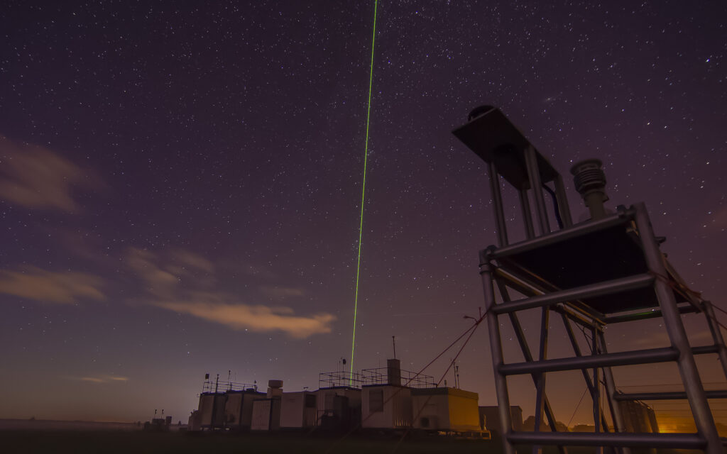
Leibniz Institute of Tropospheric Research (TROPOS) postdoctoral researcher Dr Martin Radenz is measuring aerosol-cloud interactions over Antarctica (see TROPOS box). TROPOS scientists worked with CARS and the Centre for Cloud Remote Sensing (CCRES) in Helsinki to characterize instruments such as Polly-XT, a multiwavelength polarization Raman lidar.
“This is delicate, complex technology,” says Radenz. “ACTRIS Central Facilities provide technology standards and calibration, and enable development efforts in European networks. We get together, agree on methods and evolve retrieval algorithms to provide the community with high-quality, standardized data.”
ACTRIS provides quality assurance for previously heterogeneous measurements and aspires to become a global gold standard. It specifies a standard instrument suite for aerosol-cloud research.
“A full profiling station requires a multiwavelength lidar, sun photometer, cloud radar and microwave radiometer that all meet quality standards,” says TROPOS lidar team leader Dr Holger Baars. “Then your observations are compliant. Otherwise you’re not exactly wrong, but you don’t have this quality label.”
Besides observational platforms, ACTRIS encompasses laboratories and atmospheric simulation chambers including HELIOS in Orléans, France. Manchester and East Anglia simulation chambers could follow if the UK joins, which University of Manchester emeritus professor Geraint Vaughan believes could happen in 2024.
“The Manchester chamber is a Teflon bag where urban atmospheric conditions are reproduced,” says Vaughan. “But you can control those conditions, isolate specific processes and conduct real, hypothesis-driven science. We need measurements to understand the atmosphere, but also experimental environments to test our theories.”

Data retrieval
ACTRIS develops and applies algorithms to retrieve atmospheric quantities from raw instrument data, allowing individual researchers to focus on essential science and enabling direct comparison of observations from different sensors and locations.
“The output from an instrument is millivolts or photons,” says Laj. “Going from photons to levels of atmospheric constituents can be done in different ways. In ACTRIS, the retrieval scheme ensures all our data is retrieved in the same way, so lidar measurements from Romania and Antarctica are comparable.”
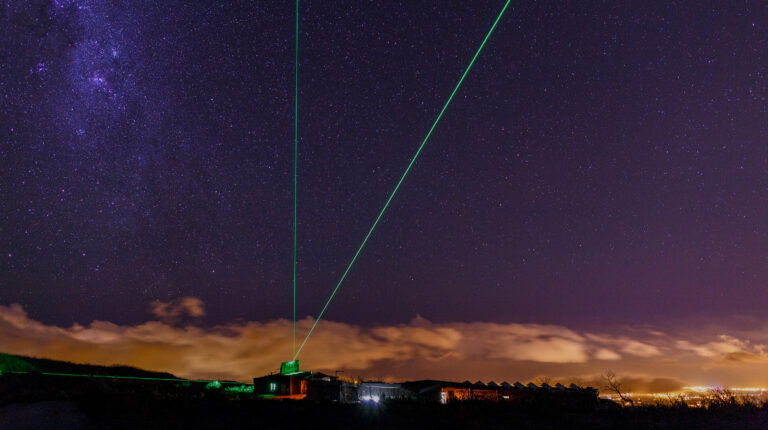
ACTRIS Central Facilities calibrate lidars for observational studies and subsequently apply a complex retrieval called the Single Calculus Chain to convert lidar outputs to intelligible observations.
“Lidars produce optical properties called the backscatter and extinction coefficients,” Radenz explains. “Retrieving aerosol size distributions is an inverse problem with many degrees of freedom. Retrievals developed and tested at Central Facilities provide quality-assured data that researchers can download from the ACTRIS Data Portal without worrying about measurement details.”
ACTRIS is committed to open-data principles and will compile and archive data sets expected to cover 135 atmospheric variables in a data center distributed across six European sites. These will be accessible to researchers, even from non-member countries, via a single data portal.
“A centralized data center is crucial for data curation, repository integrity and full data lifetime control,” comments Juurola. “There will be an easy-access, single-point entry for all our data components.”
Air quality
Reliable aerosol measurements can protect human health by informing regulations that limit particulate matter (PM) concentrations in cities. Standard air quality networks measure few parameters and cannot distinguish between emissions from a car’s engine, brakes or tires. Research into methodologies to identify aerosol sources is therefore needed for policy to better limit those sources. ACTRIS data will also be fundamental to improved climate forecasts.
“Obviously we need to decrease CO2 emissions,” says Laj. “But to produce reliable climate forecasts we need to better understand some very complex loops around aerosols and clouds, which can either warm or cool the climate depending on regional conditions.”
ACTRIS data is already shaping climate policy, since the Intergovernmental Panel on Climate Change (IPCC) made numerous references to ACTRIS science in its 2022 Sixth Assessment Report. Meanwhile, ACTRIS sites and methodologies addressed air quality questions during Covid-19 lockdowns.
“Some cities saw little decrease in PM despite the absence of cars,” says Laj. “Our colleagues demonstrated that people were emitting different particles, not from cars but from heating their homes. In 2010 the volcanic eruption of Eyjafjallajökull [in Iceland] prevented people flying home from the meeting that started ACTRIS. Our lidar component was the only instrument able to spot the plume, so we began with a good demonstration of usefulness.”
ACTRIS’s ground-based stations cover Europe well and it has established island facilities in the Atlantic and Indian Oceans. Still, it cannot provide the global measurements needed to fully understand global aerosol-cloud interactions.
“Continental Africa doesn’t yet have a single high-performance lidar or cloud radar station,” says Baars. “Even with stations in Africa, the oceans would remain a problem. Only spaceborne profiling gives a really global view, as the NASA CALIPSO lidar demonstrated.”
Lidar network
Lidar-equipped satellite missions require ground-truth measurements to validate those made from space. Over Europe, the 30-station ACTRIS lidar network offers ready ground-truth infrastructure. Baars participated in the Aeolus ground-truthing campaign (see Joint Aeolus Tropical Atlantic Campaign) and ACTRIS scientists will similarly support the ESA EarthCARE mission in 2024.
“A space agency needs to validate its products,” says Baars. “It wants access to reliable, homogeneous data from a globally distributed network of stations with harmonized data retrieval. For Aeolus, ACTRIS provided this framework and will be a validation partner for space agencies in the future.”
“The ESA has to plan the calibration and validation of missions,” says Laj. “If ACTRIS didn’t exist, the ESA would have to invent it. EarthCARE is about clouds, aerosols and Earth’s radiative budget. ACTRIS lidars will measure at the same time as the satellite passes over our stations.”
ERIC status
Where feasible, ACTRIS must add novel instruments for probing the atmosphere to its approved list. It offers testing facilities to private companies such as Airmodus, a Finnish developer of ultrafine and submicron particle counters, and may become an expertise center advising users on the reliability of commercially available sensors. The EC recently approved its establishment as a European Research Infrastructure Consortium.
“ERIC is a fast track for establishing pan-European organizations,” says Juurola. “It means we are VAT-free and can follow our own procurement rules. We don’t have all the privileges of an intergovernmental organization, but can pool resources and expertise from 17 countries. Some Central Facilities are still being implemented, but by 2027 we should be fully operational.”
This is not an end, but a beginning. Once fully formed, ACTRIS must continue to evolve, broadening its observational reach, measuring new pollutants and translating atmospheric measurements into concrete policy guidance.
“We want to develop our international dimension with observations beyond Europe,” says Laj. “Scientifically, we must respond to emerging pollutants such as nanoplastics. We must also support Europe in becoming carbon neutral and may become something like a think-tank for developing climate policies.”
This article originally appeared in the September 2023 issue of Meteorological Technology International. To view the magazine in full, click here


