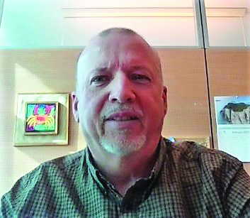
Kevin Rozario speaks with Dean Lockett, scientific officer, aircraft and surface-based remote-sensed observations at the WMO, about the upcoming drone demonstration campaign and how it may one day form a vital component of the WMO Integrated Global Observing System (WIGOS)
The quest for more accurate and timely weather forecasts is the continuous goal of all meteorological agencies. One exciting development that could move the needle significantly is the WMO’s six-month Uncrewed Aircraft Systems Demonstration Campaign (UAS-DC), which will begin in March 2024 and run until August that year.
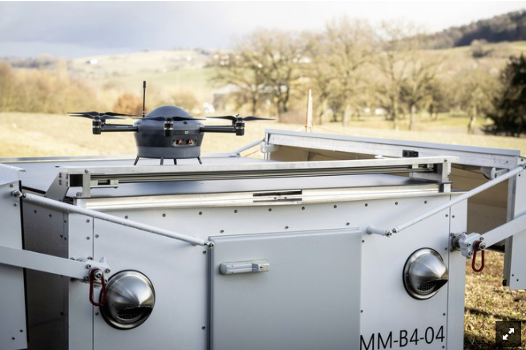
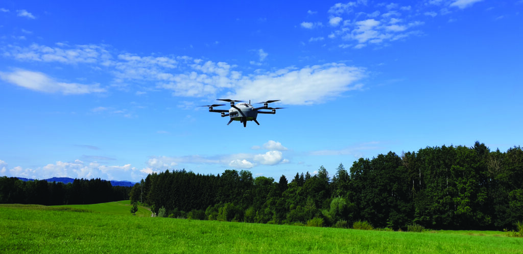
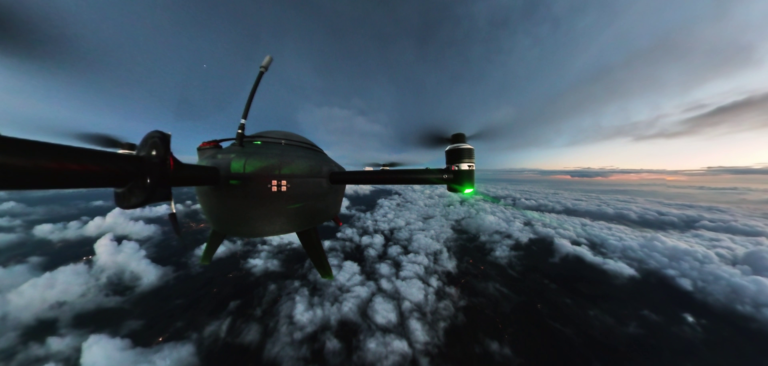
WMO issued a call for participants a year ago and is currently assembling the final shortlist. The campaign will evaluate the use of drones and larger unmanned aerial systems (UAS) to ‘fill in the gaps’ of weather forecasting and monitoring and contribute to hydrological research and operational forecasting endeavors. A likely scenario is that drone aircraft could sample the lower troposphere though the planetary boundary layer, while other aircraft could provide measurements in the upper troposphere or lower stratosphere. The call has elicited a strong response from public, government and private-sector organizations.
The campaign overlaps with the Paris 2024 Olympics in the summer, and there may be opportunities for higher-resolution observations and publicity for the campaign, although no formal agreements have been made.
Operational capabilities
UAS-DC’s chief aim is to demonstrate the technological capability of UAS to play a practical role in operational meteorological monitoring. It will also identify where these systems might be lacking. This way, plans can be made to better integrate them into operational monitoring.
 Dean Lockett, scientific officer, aircraft and surface-based remote-sensed observations at the WMO, coordinates international activities relating to observing systems under the WMO Commission for Observation, Infrastructure and Information Systems (INFCOM). His duties include the development of standards and technical guidance, and also new observing network systems and techniques to support the WMO Integrated Global Observing System (WIGOS). “I coordinate the plans and requirements for the campaign, with input from experts within the observing and research communities,” he explains.
“To demonstrate capability for operational meteorology, UAS need to routinely provide high-quality measurements of key meteorological variables in a standardized format and in near-real time, so that the data can be used by meteorological applications, such as numerical weather prediction.”
Until now, UAS has predominantly been used to aid research, but it could play a role as an operational component of WIGOS.
“This provides a potentially large range of meteorological, hydrological and climate monitoring functions,” says Lockett. “WMO is interested in determining what is required to fully develop their potential and to integrate them into operational meteorology.”
This is a complex determination. As well as the technological and data assessments, there are procedural and regulatory aspects, which necessarily would involve the International Civil Aviation Organization (ICAO) and other national airspace regulators to provide permissions and approvals.
Pushing boundaries
In the UK, the Met Office sees a lot of promise in the UAS-DC. “This is a large-scale, worldwide project looking at forecast observations of the atmosphere, particularly as high as we can go in the boundary layer,” says Dr Debbie O’Sullivan, Met Office remote sensing and airborne observations science manager. “In the past we’ve had to use radiosondes, but these can only be used once or twice a day from a certain number of locations.”
Forecasters need to measure more frequently in the boundary layer and UAS potentially offers a better alternative to radiosondes. As O’Sullivan explains, some of the challenges associated with radiosondes include the cost, limitations on altitude, lack of launch locations, the cost of helium and potential environmental concerns when balloons burst and end up in the ocean.
The idea of atmospheric monitoring ‘at will’ is still some distance away, even if all goes well with the campaign, but it is an enticing prospect for the forecasting community and has encouraged high participation rates. To date, some 68 organizations and companies have expressed a strong interest in participating, including NASA’s Airborne Science Program; the University Corporation for Atmospheric Research (UCAR) in Los Angeles, which manages the National Center for Atmospheric Research (NCAR) on behalf of the National Science Foundation, and a string of international universities.
WMO has placed almost no restrictions on who can take part, but the expectation is that there will be a larger contribution from Europe, Asia and North America. “The campaign scope aims at being global, so we are hoping for participation from many countries,” says Lockett. “A big contribution is expected from research agencies that have been advancing the use of this technology over the past decade and more.”
By mid-2023, WMO will know which agencies and institutions will fully commit and what the requirements of their roles will be. “For operators, this will mean making observations by conducting flights routinely during at least one month of the campaign and hopefully longer,” said Lockett. “By routine, we mean at least daily flights and, more likely, multiple flights per day, at least several times per week, while ensuring they operate within airspace regulatory rules.”
For data users, it will mean receiving the data generated by the operators and analyzing the quality and impact on applications, such as modeling for forecast prediction. Participants will then compile reports on the outcomes of their participation so that WMO can report on the status of UAS as potential contributors to operational meteorology.
By the end of the campaign in August 2024, WMO hopes to have demonstrated the current status of UAS technology and its capacity to contribute to operational meteorology; the requirements for UAS to be integrated into WMO’s operational observing system; the role UAS might play in filling gaps in national observing systems; and the impact of airspace regulations on the operation of weather UAS.
 New territory for UAS observations
Although drones and other types of UAS have already been used in a range of industrial, commercial and monitoring applications, including for research in meteorology, hydrology and climate, “They have not yet been used for routine, day-to-day monitoring of the atmosphere in the way that balloon-borne radiosondes do,” says Lockett. “We think these systems have potential to have such a role in meteorology, hence the campaign in 2024.”
Contemplating some of the advantages of UAS, O’Sullivan adds, “Solar-powered aerial systems can stay airborne for quite a long time and sample for longer as well as collect data from higher up, and they can also launch dropsondes.”
Further capabilities examined by the UAS-DC include operating largely autonomously and safely during flight; accurately measuring and reporting atmospheric variables such as air temperature, wind speed and direction, humidity and air pressure, among others; operating in remote regions and in a range of weather conditions; operating for long periods with efficiency and being fully recoverable (minimal environmental impact); and operating at a range of altitudes.
Participating manufacturers are yet to be announced but the WMO’s campaign information has confirmed that both rotor and fixed-wing aircraft are eligible, with “few restrictions on the types of aircraft, so long as they can reliably operate and report the required measurements”. Lockett adds, “The important measurements are those that can be used in numerical weather prediction to aid and improve forecast accuracy.”
It will be up to participants to determine what sensors their aircraft will carry and how to make the best measurements. “The campaign will not impose any restrictions or requirements on technology,” notes Lockett. “Rather, we will need to ensure a certain level of quality of data provision. Given we are trying to demonstrate operational capability, we expect that systems and sensors will have already been tested and trialled.”
The provision of accurate data will be made in near-real time and data will be transmitted to a central data repository so it can be extracted, analyzed and used by the data user community. This way, data user experts will be able to examine and test the data, as well as the results and impacts of using it in applications for weather monitoring and prediction.
A big step forward will be finding out what improvements might result from the provision of additional data from locations and times where and when such data is not usually available. This could include sending UAS into a volcanic ash cloud, for example. The Met Office hopes that there will also be improvements for observations connected to fog forecasting and convective systems such as thunderstorms, which need near-real-time nowcasting to be accurate.
 Project progress
With the UAS-DC less than a year away, the schedule has moved from developing the plans, requirements and guidance for participants to regularly holding meetings and forums to explain how the campaign will work. “Participants are making presentations on their various technologies and assisting us with analyzing and testing aspects such as flight plans and standards for data provision,” says Lockett.
WMO is also holding meetings with national airspace regulators and other stakeholders to ensure that everyone understands the regulatory requirements so that the campaign will be conducted safely. Gaining access to airspace before and during the campaign were key aspects of getting the project rolling.
Other challenges have included raising awareness and promoting participation, and also helping participants find the considerable resources required for such a long campaign.
“Finding the resources to commit to the campaign is probably the greatest challenge,” admits Lockett, particularly as the UAVs will be operated by participants at their own cost. The next major milestones are likely to be finalizing requirements for operators and data users by mid-2023 to determine participation levels, and developing the data exchange methodology and infrastructure that will allow operators to provide data in near-real time. This is expected by the end of 2023.
There is a lot riding on the results of the WMO’s campaign. Bringing together commercial, government and academic talent will help drive the best outcomes possible. And while practical deployments might still be four to five years away, knowing that UAS measurements can be done successfully and more often in near-real time will help organizations more accurately work out the cost-benefit analysis to then gain government funding to put these systems fully into play.
This article originally appeared in the April 2023 issue of Meteorological Technology International. To view the magazine in full, click here.


