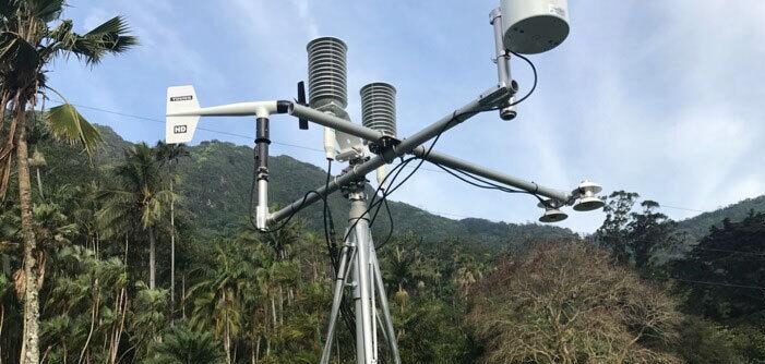
The US National Science Foundation (NSF) has awarded the University of Hawaiʻi (UH) at Mānoa a US$1.3m grant to deploy more than 80 weather stations across the state.
With funding spread across three-years, the Hawaiʻi Mesonet research project will be used to better understand the complex weather and climate of the Hawaiian Islands, which in turn will lead to improved forecasting capabilities. This is the first time the NSF has funded a mesonet system under its Major Research Instrumentation (MRI) Program.
UH Mānoa students and post-doctoral researchers will install 84 climate stations in some of the most remote parts of the state. Stations will each have a data logger, power supply with solar charging, and a telecom device enabling real-time data transmission. Participants will gain hands-on field experience in instrument installation, calibration and maintenance, while collaborating with water and natural resource managers, fire departments, and state and federal organizations.
According to Thomas Giambelluca, the project’s principal investigator and UH’s Water Resources Research Center director and Department of Geography and Environment professor, long-term observational data on rainfall, temperature and soil are unavailable from many locations that would provide valuable information relevant to atmospheric science, hydrology and ecosystems science.
“Place-to-place climate differences found in Hawaiʻi are equivalent to those of a continent, but compressed into the small area of the islands,” he said. “For example, rainfall changes from 20in to 400in per year over a distance of about 12 miles. While we already have hundreds of rain gauges, they are not enough, not located in all the right places, and many are not equipped to send out the data. Temperature, humidity, windspeed, solar radiation and other variables are measured at relatively few locations. The Hawaiʻi Mesonet will meet the needs of researchers, weather forecasters, farmers, conservation organizations and many others by providing high-quality, comprehensive measurements over the whole state.”
After collecting and analyzing the data, Giambelluca hopes the team will eventually be able to predict the probability thunderstorms may form by a process called convective initiation; identify water basin storage thresholds to better estimate the risk of flooding to low-lying areas; and discover the interactive effects of temperature, moisture and solar radiation on ecosystems.
Data will also be used to form the Hawaiʻi Climate Data Portal where users, including weather forecasters, can receive real-time data. Data will also be submitted to the National Mesonet Program supported by the National Oceanic and Atmospheric Administration (NOAA).
The research team’s co-principal investigators are David Beilman, professor, Department of Geography and Environment; Abby Frazier, affiliate graduate faculty in the Department of Geography and Department of Earth Sciences, and assistant professor at Clark University; Alison Nugent, professor, Department of Atmospheric Sciences; and Yin-Phan Tsang, associate professor, Department of Natural Resources and Environmental Management.
Beilman said, “The real-time high-resolution data availability will be unprecedented, and will allow us to better know how ‘hot moments’ and hotspots really work. A network in Hawaiʻi that connects climate from busy urban areas to remote mountains is truly novel.”
Nugent, whose research focuses on atmospheric science and weather forecasting, said, “I’m most excited with having more observations. Right now, in order to get observations together to do more research, it takes a lot of pre-work. You have to make sure the time stamps are lined up correctly and the data is quality controlled. But this will put everything all in one place. It will make it much more useful and much easier for students to use and researchers to use.”


