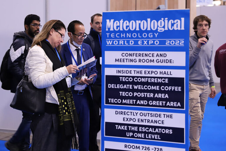
Meteorological Technology World Expo 2022, which runs until tomorrow (October 13), is maintaining momentum – here are some more of today’s highlights from the show in Paris, France…
Meteomatics presents its newly launched EURO1k European weather model
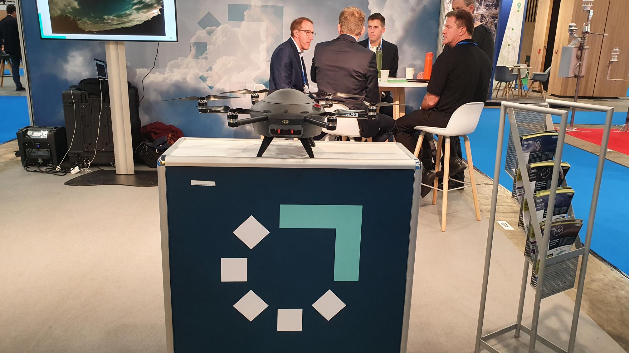 Weather drone specialist Meteomatics is proud to present its newly launched European weather model EURO1k, capable of providing fine-scale forecasts for industries across Europe thanks to its groundbreaking 1km resolution.
Meteomatics is the first company in the world to calculate a European-wide weather model with a spatial resolution of 1km, with global weather models generally working to a resolution of 20km. Hourly model calculations provide the most up-to-date forecasts, which also sets new standards in terms of forecast actuality.
Thanks to its fine-scale resolution, the model can even detect the smallest meteorological phenomena (thunderstorms and hail). Using highly accurate geodata based on downscaling algorithms, the EURO1k even achieves a spatial resolution of up to 90m.
Dr Matthias Piot, meteorologist and client manager at Meteomatics, said at the show, “This is an amazing product and has never been done before. There are other models with 1km but none of them cover the whole of Europe. One of the main things that makes it unique is the rugged refresh, which means that every hour we run the model 24 hours ahead, so it has all the latest information. It provides huge benefits for many sectors but is particularly useful for the energy and aviation sectors. Everything we measure is implemented in this model, including the information gathered by our drones.”
Alongside EURO1k, Meteomatics is showcasing its latest weather drone technology – the MM-670 – which boasts de-icing capabilities for the rotors while reaching an altitude of 6km, even in the harshest of weather.
To demonstrate its full suite of capabilities, Meteomatics is inviting potential clients to view a live demonstration this Friday, October 14, at its offices in St Gallen, Switzerland. To find out more, visit booth 3025.
LSI Lastem demonstrates its real-time heat stress risk warnings capabilities
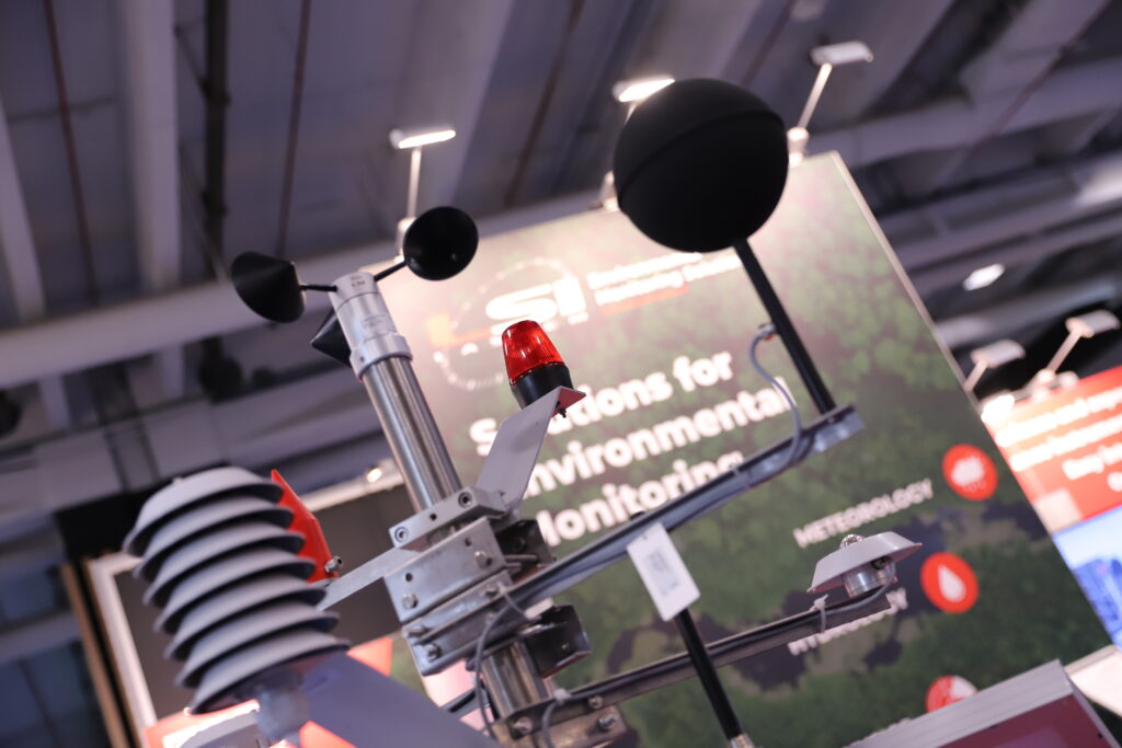 LSI Lastem is demonstrating its real-time heat stress risk warnings capabilities via its fixed weather monitoring system for continuous measurements, and its portable system for short-medium periods.
Both models can perform the verification of heat stress conditions while calculating the best-known heat stress indices (WBGT-ISO7243, PHS-ISO7933, heat index, humidex) and defining the limits for each subject, set according to their degree of acclimatization, metabolic activity and clothing.
Moreover, they can check the distance between the current situation and the defined limit and provide local alarms activated by electrical outputs or remote alarms via SMS, email and data to MQTT brokers. Additionally, they can send data to remote FTP servers, from where it can be downloaded and analyzed through specific programs. The above is supported by sensors suitable for measurements in extremely severe environments and designed according to stringent standards.
Increasing extreme heat conditions caused by global warning require the careful limiting of people’s exposure and metabolic activity to avoid serious health problems. With the situation worsening around the globe, thermal stress is affecting a larger number of subjects, especially those most at risk, such as outdoor workers, the elderly and the sick, whose metabolic activities and clothing types must be consistent with the risk of thermal stress.
LSI Lastem decided that the traditional practice of short-term monitoring to provide risk analysis to keep potential thermal stress under control is no longer sufficient. It has argued that the new paradigm for outdoor workers’ health and safety control must be the continuous monitoring of environmental conditions and initiating real-time warning systems as soon as it is necessary to limit exposure and/or metabolic activity.
Andrea Certo, CEO of LSI Lastem, said, “Because of global warming, we’re going to see increasingly hotter environments – meaning there will be more people working in hot environments. This is, very often, a big challenge. Before, people tended to use instruments for surveys, meaning they would have to go to the site, assess the situation and then go back to their base to understand the results. This is the first time that we have tried to make a real-time monitoring solution for the heat stress condition of workers. It has an alarm to ensure that workers nearby (maybe in the desert or another hot environment) can tell if it’s possible for them to actually work. This is a visual trigger, but it could trigger anything, like a control room for example. It’s becoming more and more critical to assess the conditions of the workers. We have this kind of system set, for instance, in Singapore, where sometimes there are very challenging conditions even for the people in the streets. This gives information about whether these conditions are safe or not.”
Barani Design showcases its helical solar radiation shield
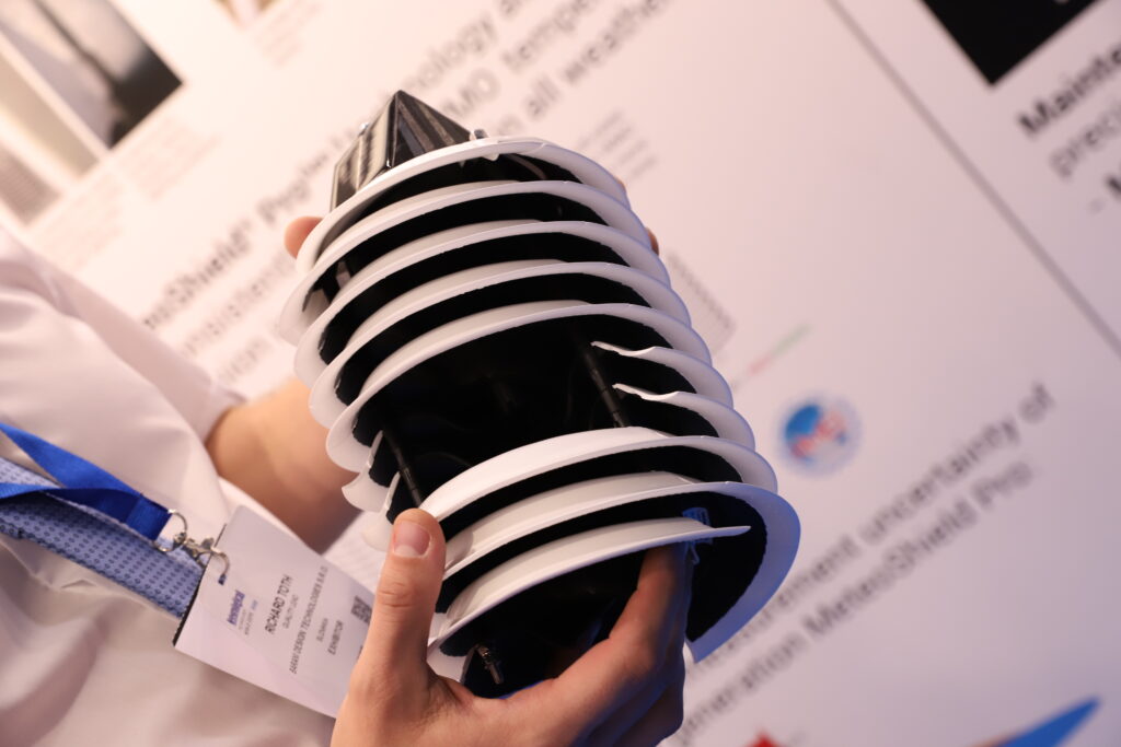 Barani Design is showcasing its helical solar radiation shield – MeteoShield Pro – for windless sunny and snowy conditions at the expo in Paris, France.
MeteoShield Pro is the culmination of feedback from users in Antarctica, the Swiss Alps and Death Valley in Nevada. The design offers improved measurement accuracy, particularly in entirely windless weather conditions, in places with lots of surface reflections from snow, or where the ground gets too hot during the day. These improvements are the result of increasing natural airflow around internal sensors and better management of light reflections from below. Although the changes may seem subtle to the naked eye, they help users in sunny and snowy locations reduce measurement uncertainty to below 0.1°C.
The third generation of the solar radiation shield also enables the addition of a solar-powered fan, without the risk of compromising its naturally ventilated performance for locations where wind speeds tend to stay below 0.5m/s.
Speaking at the show, Richard Toth, quality lead at Barani Design Technologies, said, “The new generation has a small modification to the structure of the device, on the bottom part. Many competitors had raised the issue that there is still some light going through the shield and entering the sensor at times when you have very low sunlight in the morning or evening. This increases the temperature measurement by approximately 0.10-0.05°C. However, it’s still too much of a change, from a meteorological point of view. This new model addresses this issue.
“At Meteorological Technology World Expo 2022, we’re excited to be doing business and showing people that there are a lot of new possibilities in the 21st century,” Toth continued. “They don’t need to rely on the old solutions anymore, because there are so many new technologies. For example, here it’s just a plastic shield but there is so much know-how, so much improvement against the old shields that are used by many customers. And they already outperformed also the shields used widely by the met offices.”
AEM demos its new ice build-up sensor
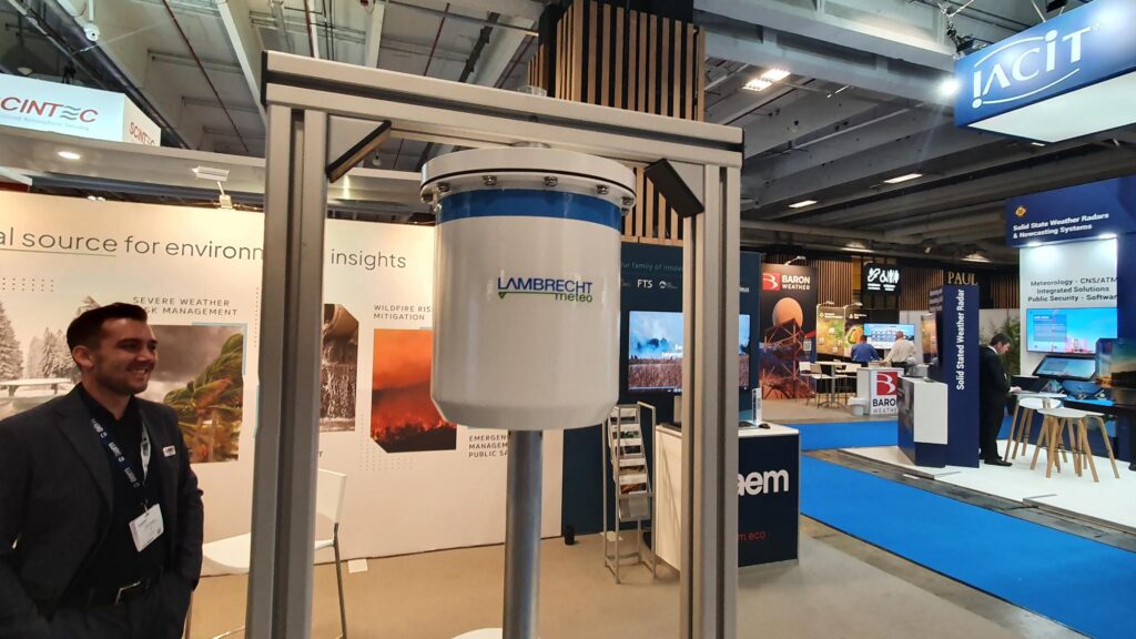 AEM is demonstrating its new Lambrecht meteo IceLoad sensor, which has been designed to help proactively mitigate risk due to dangerous ice build-up.
The IceLoad Sensor is a lightweight solution created to improve power potential, locate disturbances in delivery lines and monitor key structures for ice-related strain. Applying the same measurement principle as Lambrecht meteo’s industry-leading rain[e] weighing precipitation sensor, the IceLoad Sensor provides increased accuracy with a measurement range of up to 20kg. Its seawater-resistant aluminum construction is built to withstand harsh conditions with full year-round functionality in an environmentally friendly package free from antifreeze.
In freezing rain and frost, the weight of ice build-up can reach problematic and damaging levels that impact public safety and business operations. The IceLoad Sensor minimizes the risk and interruption icy conditions can pose to buildings, overhead power lines, wind turbines and vegetation.
Speaking at the show, Matthias Müller, product manager at AEM, said, “The IceLoad Sensor is the latest addition to our product range and builds on a long history of precipitation sensing technologies. It’s an important tool for the energy sector as it can provide an indication of ice build-up on powerlines, or the possible accumulation of large blocks of ice on wind turbines, which, if not dealt with quickly, can become a hazard when they’re flung from the turbine blades. It’s also an important sensor for giving the ice indication at an airport. It’s a new sensor from us, but there’s a lot of experience behind it from our precipitation measurement technologies. It’s also very easy to integrate with existing systems.
“The IceLoad Sensor is set to launch in summer 2023 but we are actively seeking testing partners and hope to find some at the show, especially as it’s approaching winter in Europe. We have three partners so far and we would like to find another seven!”
OTT HydroMet presents the OTT Pluvio² rain gauge
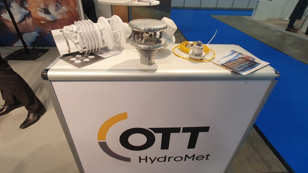 Instrumentation specialist OTT HydroMet is presenting its meteorological instruments portfolio, including ceilometers, ultrasonic anemometers and compact weather sensors, radiometers and precipitation gauges.
OTT HydroMet’s OTT Pluvio² weighing rain gauge monitors liquid and solid precipitation, including rain, snow and hail. It has been designed to only require one maintenance visit per year, to empty its bucket. The Pluvio² is available in two sizes – small and large – and is compliant with WMO-No. 8 or CIMO guidelines. Similarly, the company’s Parsivel² disdrometer is a laser-optical instrument for capturing particle size and velocity of hydrometeors, that is any kind of liquid or solid precipitation.
Lufft WS Smart Weather Sensors provide data based on radar measurements. The Lufft WS100, for example, adds precipitation measurement with a small footprint to every weather monitoring station. The Lufft WS600 includes additional sensors for wind speed and direction, air temperature and pressure, plus relative humidity – all in one housing.
Tobias Weil, business development manager for Western Europe at OTT HydroMet, said, “We have a very broad product range and come together as hydrological and meteorological experts that can offer a compact, all-in-one weather station that combines eight or nine different parameters.
“Most recently we have been working on developing a ceilometer, a cloud height measurement device called CHM8k,” Weil continued. We are already producing one of the market’s leading ceilometers in the CHM15k, which is used by many met offices globally, and starting with that as a base we developed the CHM8K for use at airports, with lower cost, lower range, specifically for aviation. It’s been a couple of years in development, but it is now ready for a hard launch.
“We think the future is clearly the combination of hardware and software. We are also looking at Data as a Service and cloud storage and bringing all of it together and offering it as one solution to the customer. Our current product base mainly focuses on hardware and offering an open interface to allow every third-party to integrate our instruments and implement the software, but the next steps will be the combination of hardware and software,” concluded Weil.
Menapia presents its meteorological unmanned aerial system
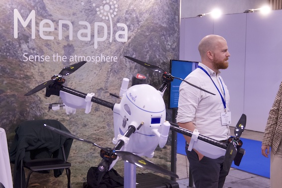 Menapia is presenting its automated, high-altitude, weather-resistant, multirotor unmanned aerial system (UAS) with integrated meteorological sensors at the expo.
The drone can fly for up to 40 minutes at a time and can hover without wind. According to the company, it provides 2km of profiling 97% of the year in the UK. The solution has a velocity of 16m/s in ascent, can ensure up to 28m/s of wind resistance and has a ceiling of 10km without wind. It has a payload of 600g, but this affects its endurance. Its surplus energy and mounting options have been included to enable an array of supplementary instruments to be carried.
The solution, MetSprite, has been designed to reduce risk while maximizing operational uptime for routine observations. Launched a month ago, MetSprite has measurements for temperature, humidity, pressure and 3D winds built into it. The solution uses sensor fusion to achieve a high response rate with minimum drift. 3D wind is measured inertially with a novel algorithm developed by Menapia for the MetSprite, or with a sonic anemometer if increased sensitivity to turbulence is desired.
With these capabilities, the startup expects MetSprite to increase the skill and confidence of short-range weather forecasts, enable wider UAS/AAM operations and testing, improve atmospheric research, and facilitate renewable energy research and operations. Menapia has also pointed out its applicability to airports.
Peter Mooney, CTO and co-founder of Menapia, said, “On board, MetSprite has sensors for temperature, pressure, humidity and wind. The fundamental difference is that the wind is measured inertially, so we have very precise positioning. This differentiates us because we then know how much drift we have horizontally. The next thing we’re going to do is a small drone that is a little bit smaller than other drones, free to upgrade and even cheaper as a solution.
“The biggest hurdle is the regulations,” he continued. “If you want to go beyond the bounds, if you want to go above 120m altitude, you want to have some more autonomy, and then you have to present the right risk assessment. It’s a case-by-case thing, there are no set standards for this. The boundary layer – the lowest few kilometers of Earth’s atmosphere – is the most turbulent, chaotic and rapidly changing space. Yet there is a significant gap in regular observations in this region, which fundamentally limits the skill that weather forecasts can provide.
“Above Earth’s surface, existing observations are costly and many offer low-quality readings for the boundary layer. The MetSprite takes a new approach using UAS technology to repeatedly profile the boundary layer and beyond. UAS are reusable, automated and resilient to the very weather conditions that they will measure. Menapia has been developing the MetSprite since 2020 and we are now ready to disrupt the market with our novel, powerful solution.”
Databourg Systems seeks new partnerships for satellite-based rain monitoring system
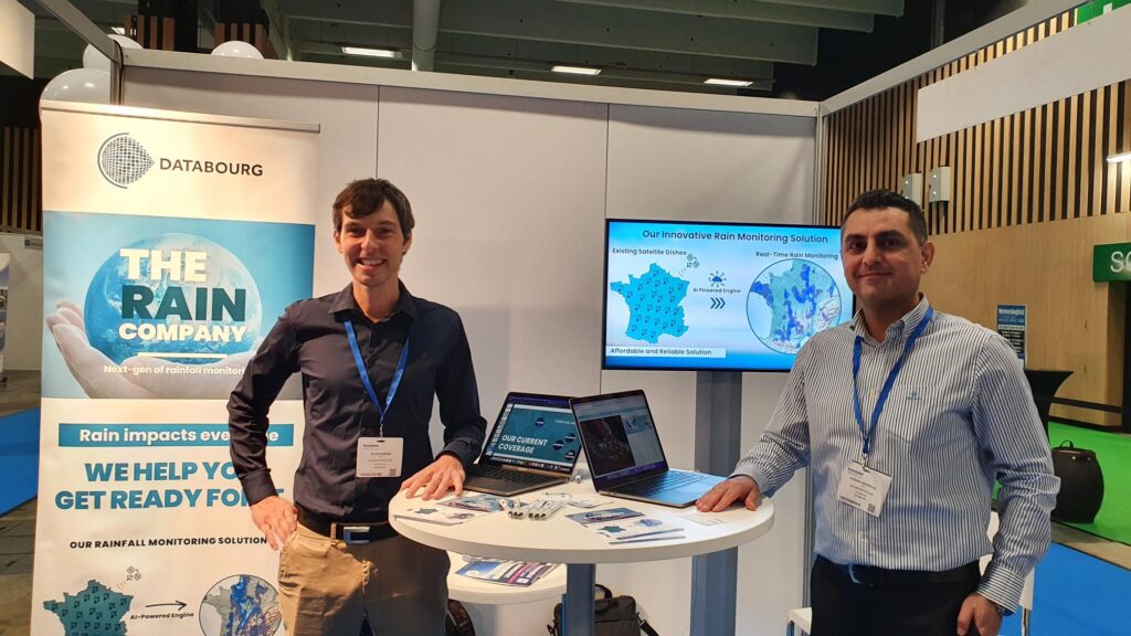 Luxembourg-based startup Databourg has announced several new partnerships to expand the reach of its new rain monitoring system.
Most recently, Databourg partnered with the environmental intelligence platform Komunidad to launch the first rain-monitoring system using satellite dishes in the Philippines. This innovative way of providing rainfall data serves to improve rain monitoring capabilities without the need for sensors and long-term maintenance.
The Philippines is one of the countries most at risk from the climate crisis, and the partnership reflects the shared mission of Databourg and Komunidad to help communities and local governments become more resilient to climate change.
Databourg, also known as The Rain Company, is a spin-off of the University of Luxembourg’s Interdisciplinary Centre for Security, Reliability and Trust. The data analytics company has developed an innovative technology for rainfall monitoring using satellite communication signals, specifically the fluctuations of satellite signals. It takes this signal quality data and applies machine learning algorithms to generate highly localized rainfall data, in real time.
Databourg’s rain monitoring sensors are already operational in France, New Zealand and Indonesia as well as in the Philippines, but it is continuing to expand into new markets in Asia and South America.
The company is now keen to expand its reach even further by partnering with met services for small island and developing states, as well as building new relationships with communication satellite operators.
Dr Ahmad Gharanjik, CEO and founder of Databourg, said, “We get the data from satellite operators who already have this data and we transform it into rain data. Our focus is more on underdeveloped countries that don’t have rain monitoring infrastructure or radar coverage. We use very high-frequency signals, so they’re only ever impacted by rain. It’s real-time data, every five minutes. The most challenging part is acquiring the data from satellite operators, so if we can develop any relationships through the Satcom forum that would be ideal.”
Microcom previews its satellite transmitter ahead of its 2023 launch
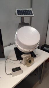 Microcom is demonstrating a model of its GTXO-2.0 Satellite Transmitter, which is set to launch in the first quarter of 2023, at Meteorological Technology World Expo.
The satellite transmitter has been created to better meet the needs of Microcom’s clients and provide a more cost-effective option. This is because many of its clients replace the GTX-2.0’s datalogger with their own datalogger and only use the satellite transmitter functionality.
As with its predecessor, the GTXO-2.0 will be able to support satellite transmissions to a worldwide set of data collection systems, including NOAA/GOES, EUMETSAT, JMA/Himawari, INSAT and ARGOS/SCD.


