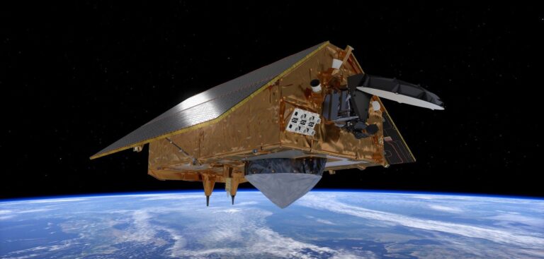
The Sentinel-6 satellite that will allow scientists to measure sea level rise has recently been launched on a SpaceX rocket. It will orbit 830 miles above the planet, collecting data that is indispensable for ocean and weather forecasts and climate understanding over the next decade.
Dr Matthew Palmer, lead scientist on sea level rise from the UK’s Met Office Hadley Centre, commented, “Sea-level rise poses one of the greatest socioeconomic challenges associated with climate change. Space-based observations since the 1990s have revolutionized our understanding of rates sea-level rise around the globe. The Sentinel-6 observations are critical for ongoing monitoring of global sea level and revealing the spatial pattern of rise associated with climate change. These new observations will play a key role in the development of improved modeling systems and projections on a range of timescales by providing invaluable insights into sea-level variability and change around the world.”
John Siddorn, head of ocean forecasting R&D and co-chair of the UK’s National Partnership for Ocean Prediction, added, “Altimeter satellites are fundamental to ocean monitoring and prediction – it is no coincidence that most ocean re-analysis data sets, used to understand the marine environment, start around the early 1990s, to coincide with the launch of the first reference satellite altimeter missions. The Sentinel-6 satellites ensure the continuation of this vital data record for the next decade, safeguarding our ocean monitoring and prediction capability that is so important for marine operations as well as understanding the changing world we live in.”
The joint European and US satellite is named Sentinel-6 Michael Freilich, after Dr Michael Freilich, the former director of NASA’s Earth Science Division. The European contribution is shared between ESA, EUMETSAT and the EU. It will provide the only means of measuring global sea level changes with sufficient accuracy to detect a sea level rise due to climate change.
Airbus Defence and Space in Stevenage, UK, designed, manufactured and tested the propulsion module for the Sentinel-6 satellite. The hydrazine propulsion system with eight thrusters will maintain the 1.3-ton satellite in the correct orbit for its mission.
This mission will take on the role of radar altimetry reference mission, continuing the long-term record of measurements of sea-surface height started in 1992 by the French–US Topex Poseidon and then the Jason series of satellite missions.


