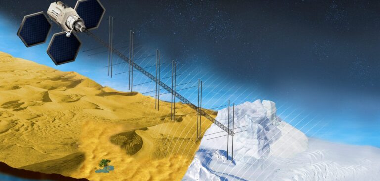
A joint effort between NASA and the Qatar Foundation aims to further understanding of the effects of climate change on desert environments. To this end, researchers with the Orbiting Arid Subsurfaces and Ice Sheet Sounder (OASIS) study project are designing a satellite mission to probe the sand dunes and ice sheets of some of Earth’s driest places with radar technology similar to that used by NASA’s Mars Reconnaissance Orbiter (MRO). The project’s primary goal would be to discover and monitor underground sources of fresh water otherwise known as aquifers.
Under a reimbursable Space Act Agreement with NASA and the Qatar Foundation (QF) for Science, Education & Community Development – represented by Hamad Bin Khalifa University (HBKU) and the Qatar Environment and Energy Research Institute (QEERI) at HBKU – NASA’s Jet Propulsion Laboratory and QEERI will jointly formulate a mission concept study for Qatar’s prospective OASIS mission.
The project seeks to put a satellite in Earth orbit to map the distribution of shallow aquifers beneath the desert’s surface in North Africa and the Arabian Peninsula. The plan is to use the satellite’s radar instruments to study how those aquifers originated and how groundwater moves beneath the deserts through a complex system of subsurface fractures that interlink them.
“The scientific community is excited about this mission. OASIS would be the first spaceborne radar specifically designed to detect directly subsurface water on Earth,” said James Graf, director for Earth Science and Technology at JPL in Southern California.
Project researchers also intend to study the topography of the land under ice sheets in Greenland and Antarctica to determine such properties as ice sheet thickness and the pathways by which ice flows to the ocean. This information could feed into models of current and future ice sheet responses to climate change, which would help researchers better understand ice sheet contributions to sea level rise.
“Warm and cold deserts are responding to climatic changes by expanding and shrinking, respectively,” explained Essam Heggy, the OASIS principal investigator and chief scientist and research program director of the Earth Science Program at QEERI. “Studying the forces driving these transformations will give us insight into the evolution of deserts on Earth.”
Led by Artur Chmielewski, the OASIS study project manager at JPL, and Heggy, the project’s team plans to design a spaceborne mission that uses radar technology similar to that developed for MRO to explore beneath the Martian surface. The instrument under consideration for the OASIS project, a 50MHz sounding radar, is expected to penetrate up to 1.8 miles (3km) of ice and nearly 330ft (100m) of sand.
In a 2011 proof-of-concept mission, researchers flew a helicopter over two well-known freshwater aquifers beneath Kuwait’s deserts to ensure a radar sounding instrument could detect them. They conducted several similar flights over other deserts in Oman and Morocco.
The OASIS study project will expand the scope of those initial efforts for a more global picture. The researchers and engineers involved in the project hope to finish formulating the mission concept over the next two years.


