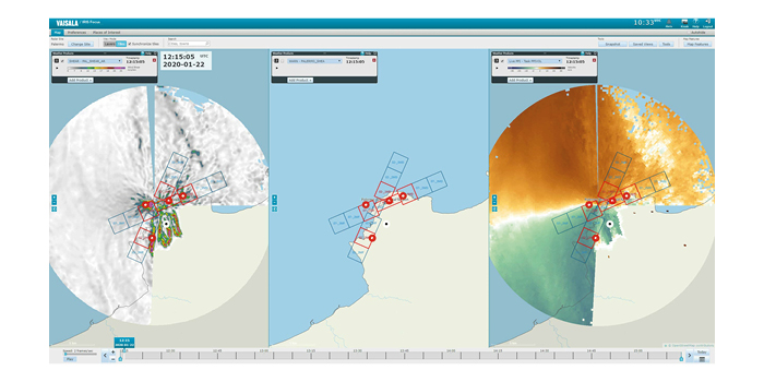
Vaisala has released the latest iteration of IRIS Focus, an advanced remote sensing software that provides “superior understanding” of storms and weather fronts to support safe operations at airports.
The web-based software is used to visualize and process data generated by weather radars, wind lidars and lightning detection networks. The most recent iteration better detects and characterizes low-level turbulence, offers a unique range time indicator, groups events, and enables secure remote access to weather alerts.
“As our changing climate increases the frequency and severity of extreme weather events, precise weather insights and rapid alerts are more important than ever for meteorologists, forecasters and decision-makers at the airport,” said Ludovic Thobois, IRIS Focus product manager at Vaisala. “By providing a rich set of unique tools for viewing and analyzing your weather data from various sources, IRIS Focus provides unmatched insights to drive swift, informed decision making.”
IRIS Focus combines weather radars, wind lidars and analysis tools to provide interactive weather data visualization, integrated decision-making support, high cybersecurity standards and faster remote sensor data analysis for alert generation and nowcasting of weather hazards like wind shear phenomena along approach and takeoff paths. This unique remote sensing software solution empowers forecasters and meteorologists at airports to anticipate potential risks to people, activities and infrastructure.
IRIS Focus now implements the following unique and industry-leading features:
- Turbulence Characterization: Leveraging wind lidars, the turbulence product calculates the turbulence from Doppler wind lidar velocities measured with pointing scans and assesses the severity of low-level turbulence.
- Range Time Indicator: A two-dimensional display of time and range of different data types provides a more detailed visualization of weather radar and wind lidar data for investigating cloud/aerosol layers, boundary layers, convection, and wind gusts.
- Group Events: This feature creates fully configurable weather events and alerts based on multiple criteria that can be applied to existing products for each remote sensor.
- Alert API: This interface function makes it possible for remote users or systems to receive ongoing weather alerts.
The IRIS software suite has been a market-leading solution, helping thousands of users worldwide maximize their remote sensors, weather radars and wind lidars. Since its 2016 launch, the easy-to-use and -configure solution enables simple visualization and sharing of data between stakeholders through its web-based architecture. With the addition of lightning data, IRIS Focus can generate on-demand products and weather alerts for specified geographical area-configured weather events.


