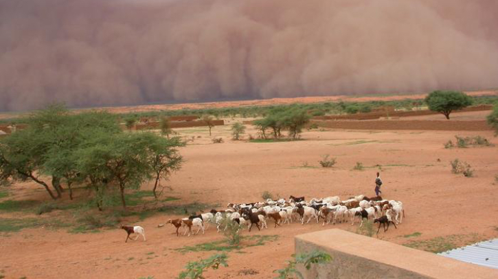
According to a new study by the UK Centre for Ecology and Hydrology (UKCEH), the University of Leeds (UK) and the Pacific Northwest National Laboratory (USA), measurements of land surface conditions are set to transform early warning systems in tropical regions.
The new study, published in Nature Geoscience, is part of ongoing UKCEH research funded by the Natural Environment Research Council (NERC). A previous study found land surface conditions often affect the direction and intensity of megastorms in the Sahel after they have formed, while a separate paper showed that deforestation increases the frequency of storms in some fast-growing African coastal cities.
Improving warnings
The study involved a detailed analysis of 20 years of satellite data relating to storm activity and soil moisture conditions in West Africa, southern Africa, India, South America, as well as computer modeling.
The research focused on mesoscale convective systems, which bring severe flash flooding and mudslides in parts of Africa, Asia, Americas and Australia that collectively have a population of nearly four billion people.
The researchers found surface conditions that influence rainfall can be observed two to five days before a storm hits, which will enable advance warning of potential flash flooding.
Rethinking forecasting
“Meteorologists tend to focus on atmospheric conditions to predict weather patterns. But, as a growing amount of evidence shows, we should also consider what is happening on the land surface to improve forecasting,” said study co-author Dr Cornelia Klein, a meteorologist at UKCEH.
The study authors explained that the greater contrast in moisture between wetter and drier areas over a large distance results in a greater contrast in air temperatures, leading to stronger shifts in wind direction and/or speed as you go higher up in the atmosphere. This turbulence helps storms grow, producing more rainfall over a larger area.
In addition to their analysis in West and southern Africa, India and South America, the researchers observed the same connection between soil moisture contrasts and wind circulations in China, Australia and the US Great Plains. So while there was insufficient storm data to carry out a full analysis, they are confident that soil moisture contrasts are also exacerbating rainfall in other regions affected by mesoscale convective systems.
Developing accurate tools
The next step planned for the researchers is exploring what factors contribute to these regional variations. They are also using the latest advanced climate models, which better incorporate storms, to improve understanding of the processes that make rainfall more intense as temperatures continue to rise under global warming.
Computer software tools being developed by UKCEH are enabling meteorological agencies to generate more reliable short-term forecasting (up to six hours ahead of storms) and therefore warnings to communities about approaching storms. These include an online ‘nowcasting’ portal based on satellite-derived data on atmospheric and soil conditions in Africa.
Lead author Dr Emma Barton, a meteorologist at UKCEH, said, “Mesoscale convective systems are some of the most intense thunderstorms on the planet, and are increasing in severity due to climate change. Rising temperatures could increase the contrast between wet and dry areas of soils, further intensifying thunderstorms in already severely impacted regions.
“Understanding how soil moisture influences storm activity, and how this may change in the future, will be essential for more accurate short-term forecasting to warn communities about approaching storms, as well as making longer-term projections.”
In related news, the UK Centre for Ecology & Hydrology (UKCEH) recently opened an office in Accra, Ghana, to improve its meteorological collaboration with communities in the region. Click here to read the full story.


