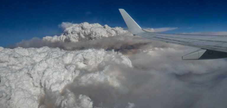
The bushfires blazing in Australia since early November have been unprecedented in their level of destruction, turning an area of more than 23,000 square miles into scorched earth.
They have also given rise to a rare meteorological phenomenon that the US space agency NASA has dubbed “the fire-breathing dragon of clouds”.
Known as pyrocumulonimbus, it is one of two types of clouds caused by large wildfires – the other is pyrocumulus.
The pyrocumulus clouds can form over wildfires because of the rising heat. If they grow big enough they transform into pyrocumulonimbus clouds, which are similar to cumulonimbus, the clouds most often associated with thunderstorms.
Pyrocumulonimbus can also cause thunderstorms and can even produce rain. According to meteorologists they can exacerbate the dangers posed by wildfires by generating lightning which in turn can lead to new blazes being started. Satellite images have captured these huge clouds forming along the coast of New South Wales and Victoria.
Nor are they the only weather phenomenon associated with Australia’s bushfires. Fire whirls, also known as fire devils, are whirlwinds composed of flame or ash. They are caused when intense rising heat and turbulent wind conditions combine to form whirling eddies of air.
One such fire whirl caused a bushfire on Kangaroo Island in South Australia to jump containment lines, leading to further evacuations.


