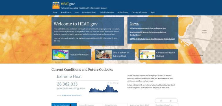
The US government, through the interagency National Integrated Heat Health Information System (NIHHIS), has launched a new website to provide decision-makers and the public with clear, timely and science-based information to understand and reduce the health risks of extreme heat.
Heat.gov offers maps, data and information from across disciplines, from inside and outside of government, that will enable informed decisions by communities on a daily basis and allow planning weeks and months ahead. The site features heat information from across federal agencies, including heat forecasts from NOAA’s National Weather Service, the new national Climate and Health Outlook developed by the Department of Health and Human Services, the Centers for Disease Control and Prevention’s (CDC) Heat and Health Tracker, as well as heat planning and preparedness guides.
Extreme heat has been the greatest weather-related cause of death in the USA for the past 30 years, more than hurricanes, tornadoes, flooding or extreme cold – killing over 700 people per year. In addition, the heat crisis does not affect people equally. Extreme heat mortality disproportionately affects Native American and Black communities, as well as those living in the urban core or very rural neighborhoods, according to the CDC.
Heat.gov will provide a one-stop hub on heat and health for the USA and is just the latest measure to address extreme heat. With funding from the Bipartisan Infrastructure Law, the Biden Administration has invested in programs to build resilient infrastructure that helps communities withstand extreme heat, drought, wildfires and other heat-related hazards.
Gina McCarthy, White House National Climate Advisor, said, “Heat.gov is an exciting new and accessible website designed to help everyone become engaged with their community, their state-level government and federal partners, to take actions that can reduce the deadly health impacts of extreme heat.”
Heat.gov was created in collaboration with Esri, a geographic information system company. The website is hosted on Esri’s cloud-based geospatial platform, which allows easy access to a range of features, such as localized heat information, links to heat tools across the federal government, and an interactive map of the NOAA and NIHHIS urban heat island mapping campaigns.
Dr Rick Spinrad, NOAA administrator, said, “Extreme heat is a global health threat, and due to human-caused climate change, it’s getting worse. Reducing the risks of extreme heat in our country requires a whole-of-government effort, which is why NOAA has led a large federal coalition to create, launch and manage Heat.gov. This website will improve public health and help us build a climate-ready nation.”


