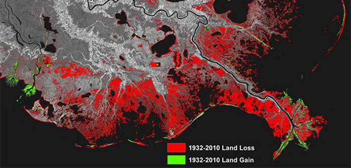
NASA is set to launch an airborne mission aimed at understanding the impact of sea level rise on the Mississippi River Delta.
Research flights over the delta region in coastal Louisiana will investigate why some parts of the delta are disappearing under rising seas while others are not.
“Millions of people live on, and live from services provided by, coastal deltas like the Mississippi River Delta,” said the project’s lead investigator Marc Simard of NASA’s Jet Propulsion Laboratory in Pasadena, California. “But sea-level rise is causing many major deltas to lose land or disappear altogether, taking those services with them.”
The Mississippi River Delta, one of the world’s largest, has been particularly hard hit. According to NASA the delta region has lost some 2,000 square miles of wetlands in the last 80 years.
This land loss has major implications for the industries – such as shipping, fishing and tourism – and the wildlife that rely on the delta. In the face of sea level rise it could have wider implications for the surrounding region since deltas typically protect inland areas from wind and flooding during storms.
The disappearance of parts of the delta is due to those area being unable to accumulate sediment fast enough to offset sea-level rise and ground sinking – caused by extracting too much subterranean water, petroleum and natural gas.
Over the course of two field campaigns, one in April and one in the autumn, the NASA team will try to understand how and why sediment accumulates in some areas and not in others. As well as looking at how rising seas will impact this process.
The airborne campaign, which will be backed up by boats, will focus on two locations that have gained and lost land respectively: the Atchafalaya Basin and northwest of Terrebonne Bay.
During the mission, known as Delta-X, the team will use specialized remote-sensing instruments to measure how much water flows through the river’s channels and how much of it overflows to the wetlands. They will also detect the amount of sediment in the water and how much of it gets deposited on land.


