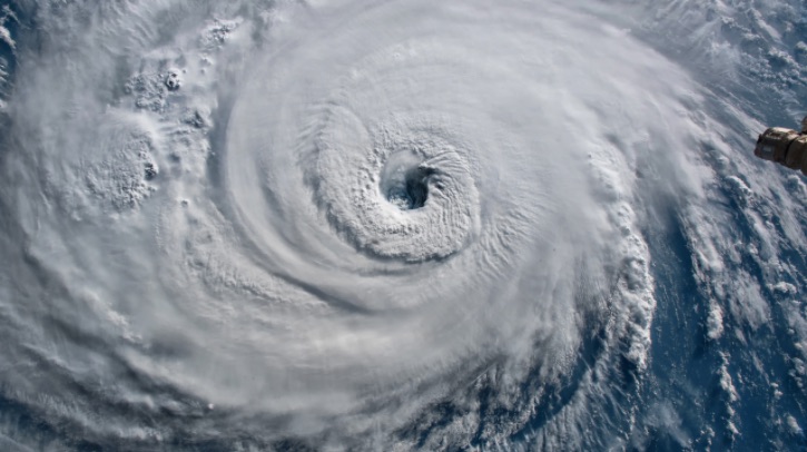
A research team at the University of Reading has used a UK Met Office forecasting software to predict hurricane patterns up to 10 years in advance – and projects that, over the next decade, tropical cyclone numbers in the Atlantic could more than double compared to 1970s levels, while East Pacific activity could increase by more than a third.
Improved hurricane forecasting
The study, published this month in npj Climate and Atmospheric Science, used the Met Office‘s DePreSys4 climate prediction software and a specialized tracking algorithm to forecast future hurricane patterns. According to the researchers, the study marks a major advance in hurricane prediction by tracking individual storms within the model’s simulations rather than relying on indirect indicators like sea level pressure or sea surface temperature patterns. While direct storm tracking is already used for short-term forecasts of days or months, this is the first time it has been successfully applied to predict hurricane patterns up to a decade ahead. This longer-term view gives communities unprecedented insight into future storm risks.
Paul-Arthur Monerie, lead author of the research at the National Centre for Atmospheric Science (NCAS) at the University of Reading, said, “Until now, hurricane predictions have been like trying to see through a dense fog as we could only make out what was directly ahead of us. Better forecasting clears that fog away, revealing patterns years into the future. This advancement gives coastal communities precious time to prepare. Our study shows hurricane activity is set to increase through 2030, giving everyone more time to prepare and protect themselves.”
Warmer oceans and wind variety
The total energy of these storms – which combines their frequency, strength and duration – is predicted to increase dramatically. In the North Atlantic, storm energy could rise to twice its 1970s levels.
The predicted rise in hurricane activity is linked to two key environmental factors: ocean surface temperatures and wind patterns in the atmosphere. The forecasting system shows that Atlantic Ocean temperatures are likely to be higher in the coming years, providing more energy for hurricanes to form and intensify. At the same time, changes in wind patterns – particularly how winds vary at different heights in the atmosphere – are expected to create more favourable conditions for hurricane development. These changes are driven by a combination of natural climate variations and longer-term climate trends.
In related news, NSF NCAR recently run simulations on the Cheyenne supercomputer at the NCAR-Wyoming Supercomputing Center to tease out the influence of Kelvin waves – the large-scale atmospheric waves that can extend more than 1,000 miles in the atmosphere and shape global weather patterns – and anticipate clusters of hurricanes days to weeks in advance. Click here to read the full story.


