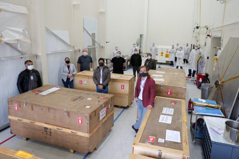
A key milestone in the development of the NISAR spacecraft has recently been reached thanks to the delivery of an important piece of equipment – the S-band synthetic aperture radar (SAR).
NISAR is a joint mission between NASA and the Indian Space Research Organization (ISRO). The spacecraft is currently taking shape at NASA’s Jet Propulsion Laboratory in Southern California, USA.
On March 19, NISAR’s assembly, test, and launch team at JPL received the S-band SAR from its partner in India. The spacecraft will use the S-band SAR along with an L-band SAR provided by JPL to measure changes in Earth’s surface.
The “S” and “L” denote the wavelength of their signal, with “S” at about 4in and “L” around 10in. Both can see through objects like clouds and the leaves of a forest canopy that obstruct other types of instruments, although L-band SAR can penetrate further into dense vegetation than S-band. This ability will enable the mission to track changes in Earth’s surface day or night, rain or shine.
The satellite will use a wire mesh radar reflector antenna nearly 40ft in diameter – the largest reflector antenna ever launched by NASA – at the end of a 30ft-long boom to send and receive radar signals to and from Earth’s surface.
This animation shows how the NISAR spacecraft will deploy its radar reflector antenna after launch (credit: NASA/JPL-Caltech):
By tracking subtle changes in Earth’s surface, NISAR will spot warning signs of imminent volcanic eruptions, help to monitor groundwater supplies, track the melt rate of ice sheets tied to sea level rise, and observe shifts in the distribution of vegetation around the world.
According to NASA, monitoring these kinds of changes in the planet’s surface over nearly the entire globe hasn’t been done before with the high resolution in space and time that NISAR will deliver.
NISAR will detect movements of the planet’s surface as small as 0.4in over areas about the size of half a tennis court. Launching no earlier than 2022, the satellite will scan the entire globe every 12 days over the course of its three-year primary mission, imaging the Earth’s land, ice sheets, and sea ice on every orbit.
“NISAR is an all-weather satellite that’s going to give us an unprecedented ability to look at how Earth’s surface is changing,” said Paul Rosen, NISAR project scientist at JPL. “It’ll be especially important for scientists who have been waiting for this kind of measurement reliability and consistency to really understand what drives Earth’s natural systems – and for people who deal with natural hazards and disasters like volcanoes or landslides.”
Engineers and technicians from JPL and ISRO will spend the next couple of weeks performing a health check on the radar before confirming that the L-band and S-band SARs work together as intended. Then they’ll integrate the S-SAR into part of the satellite structure.


