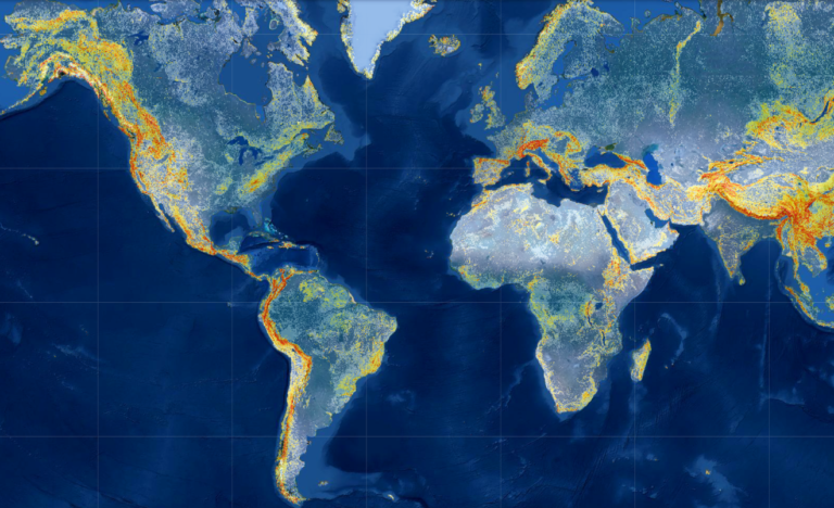
NASA has released an upgraded version of its Global Landslide Hazard Assessment (LHASA) model and mapping tool, which identifies potential landslide activity anywhere between the poles in near real time.
LHASA Version 2 is a machine-learning-based model that analyzes a collection of individual variables and satellite-derived datasets to produce customizable nowcasts. These nowcasts are estimates of potential landslide activity in near real time for each 1km2 area between the poles.
The model factors in the slope of the land, distance to geologic faults, the makeup of rock, past and present rainfall, and satellite-derived soil moisture and snow mass data.
“The model processes all of this data and outputs a probabilistic estimate of landslide hazard in the form of an interactive map,” said Thomas Stanley, Universities Space Research Association scientist at NASA’s Goddard Space Flight Center in Greenbelt, Maryland. “This is valuable because it provides a relative scale of landslide hazard, rather than just saying there is or is not landslide risk. Users can define their area of interest and adjust the categories and probability threshold to suit their needs.”
To teach the model, researchers input a table with all of the relevant landslide variables and many locations that have recorded landslides in the past. The machine learning algorithm takes the table and tests out different possible scenarios and outcomes; when it finds the one that fits the data most accurately, it outputs a decision tree. It then identifies the errors in the decision tree and calculates another tree that fixes those errors. This process continues until the model has learned and improved 300 times.
“The result is that this version of the model is roughly twice as accurate as the first version of the model, making it the most accurate global nowcasting tool available,” said Stanley. “While the accuracy is highest – often 100% – for major landslide events triggered by tropical cyclones, it improved significantly across all inventories.”
Version 1, released in 2018, was not a machine learning model. It combined satellite precipitation data with a global landslide susceptibility map to produce its nowcasts. It made its predictions using one decision tree largely based on rainfall data from the preceding week and categorized each grid cell as low, moderate or high risk.
LHASA Version 2 also adds a new exposure feature that analyzes the distribution of roads and population in each grid cell to calculate the number of people or infrastructure exposed to landslide hazards.


