Météo-France has just deployed new versions of its numerical weather prediction (NWP) models, Arpège and Arome. The organization says this upgrade will improve the quality of forecasts by 3-4% and mean the country’s weather model can be ranked second in the world for European forecasts.
Arpège is a global variable-resolution NWP model, adapted to the operational constraints of France, that enables forecasts up to four days ahead. Arome is a limited-area NWP model that provides detailed forecasts up to two days ahead for mainland France and the country’s overseas territories. Probabilistic variations of these two models, known as ensemble forecasting systems, complement the range of models at Météo-France to better estimate forecasting uncertainties.
Better cyclone forecasting
The geographical area of the Arome model over the Indian Ocean has been expanded by about 20% to the north, creating better modeling of the cyclone formation phase and improved anticipation of depression phenomena that could threaten Mayotte.
Increased number of observations
The number of observations entering the organization’s most detailed model covering mainland France (Arome) has tripled to reach 4.2 million data points per day, up from 1.4 million previously. This increase in data allows for a more precise description of initial weather conditions and thus better simulation of their evolution.
More forecast scenarios available
Météo-France runs its models several times a day to continuously update forecasts with the latest available observations and produce a set of evolution scenarios. The number of scenarios produced by the Arome model for mainland France each day has increased from 76 to 108. This evolution gives better sampling of possible scenarios and helps forecasters better estimate confidence in the preferred scenario.
Positive evaluation results
The positive results of the performance indicators have also been confirmed across a range of notable past cases. The example below of a Mediterranean episode illustrates the contribution of the improvement for the Arome model. Comparable improvements have been achieved for other Mediterranean episodes or storm situations.
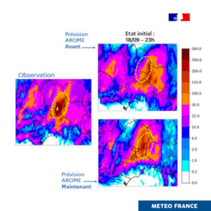
Intense rain episode in the Cévennes (September 19, 2020)

On the left: the total precipitation observed during the episode (from September 19 at 6am to September 20 at 2am).
The upper panel shows the precipitation totals predicted by Arome the day before, using the previous production system.
The lower panel illustrates the totals predicted by the new forecasting system.
At 11pm, seven hours before the event began, the new system forecasted the heaviest rainfall in the west of Gard and the east of Lozère (inside the yellow ellipse), as observed. Additionally, the location of the predicted heavy rainfall was more variable with the previous system from one simulation to another.
Return to the Mediterranean episode in Spain
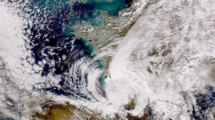
The southeast of Spain was hit by an exceptional Mediterranean episode at the end of October. It caused very heavy rains and flooding, resulting in a significant human toll. The new version of the forecasting system for Arome accurately modeled the rainfall totals that were observed the day before. This is an important result that demonstrates our models’ ability to simulate such events, which will become more extreme and frequent due to climate change.
Real-time data available for free
Like all public data from the organization, the results of the Arome and Arpège numerical weather prediction models are available for free in real time on the website meteo.data.gouv.fr. The forecasts from the new system replace the old ones without any action required from users.
Continuous improvement of forecasting
According to the organization, the collaborative efforts of researchers, forecasters, engineers and technicians at Météo-France yield a few hours of improvement in forecasting every two years (the new system gains two to five hours for Arpège, depending on the parameters) and result in an approximate gain of one day every 10 years. This means that today, the forecast for maximum temperatures two days ahead is as accurate as the forecast for the next day was 10 years ago.
Improvement of numerical weather prediction
To assess the quality of forecasts, performance indicators measure the relevance of predictions over various timeframes. The indicator for the deterministic forecast of the Arome model, which evaluates the reliability of precipitation and wind gust forecasts for mainland France, has improved by nearly 4% over the next two days. This improvement is apparently noticeable year round, particularly in summer, which should benefit thunderstorm forecasting.
In related news, Météo-France recently deployed a second buoy near Corsica to support extreme weather forecasting. Click here to read the full story.


