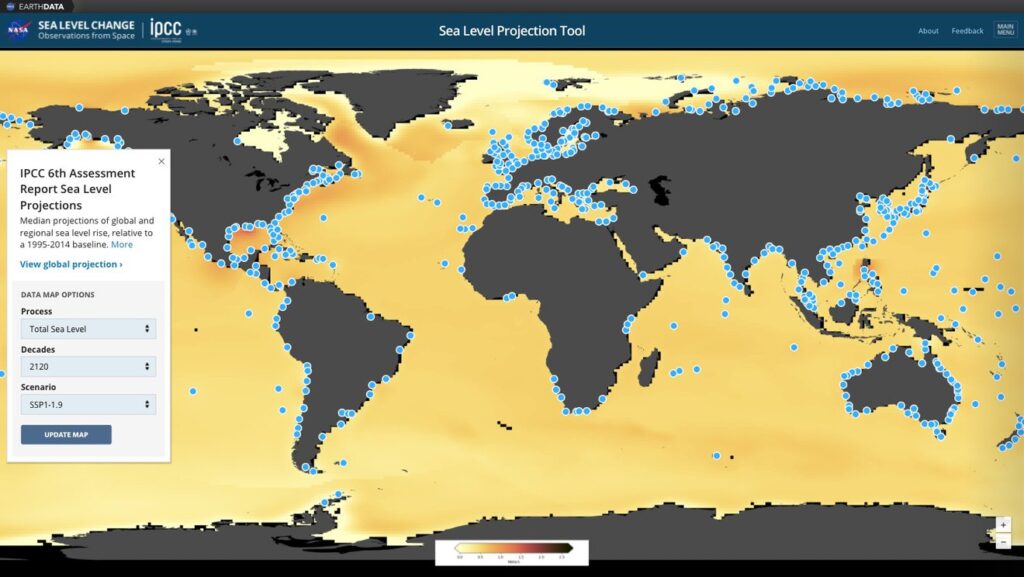
A new online visualization tool will enable anyone to see what sea levels will look like anywhere in the world in the decades to come.
NASA’s Sea Level Change Team has created a sea level projection tool that makes extensive data on future sea level rise from the Intergovernmental Panel on Climate Change (IPCC) easily accessible to the public.
The tool, hosted on NASA’s Sea Level Portal, delivers detailed reports for any location based on the projections in the IPCC’s Sixth Assessment Report, released on August 9, which addresses the most updated physical understanding of the climate system and climate change.
The IPCC has provided global-scale assessments of Earth’s climate every 5-7 years since 1988, focusing on changes in temperature, ice cover, greenhouse gas emissions, and sea level across the planet. Its sea level projections are informed by data gathered by satellites and instruments on the ground, as well as analyzes and computer simulations.

Nadya Vinogradova Shiffer, program scientist and manager at NASA, who directs NASA’s Sea Level Change science team, said, “As the first data-delivery partnership between the IPCC and a federal agency, NASA’s new sea level projection tool will help pave the way for future activities that facilitate knowledge sharing, open science, and easy access to the state-of-the-art climate science. This information is critical to increase climate resilience of nations with large coastal populations, infrastructure, and economies that will be impacted by sea level rise.”
Along with providing snapshots of rising sea levels in the decades to come, the tool enables users to focus on the effects of different processes that drive sea level rise. Those processes include the melting of ice sheets and glaciers and the extent to which ocean waters shift their circulation patterns or expand as they warm, which can affect the height of the ocean.
View the projection tool here: https://sealevel.nasa.gov/ipcc-ar6-sea-level-projection-tool


