The Department of Commerce and NOAA will invest US$26m over four years in the National Weather Service (NWS) National Mesonet Program and the National Integrated Drought Information System (NIDIS) to support the development of a transformative federal-state-private partnership to provide improved early warning for drought, flooding, fire and other natural hazards.
This investment forms part of President Biden’s Investing in America agenda under the Bipartisan Infrastructure Law. The US Army Corps of Engineers (USACE) will partner with NOAA on this pilot program. The funds will enable NOAA and USACE to help communities build resilience to natural hazards that can be influenced by climate change in the five Upper Missouri River Basin states of Montana, Wyoming, the Dakotas and Nebraska, and ultimately across the nation.
“As the impact of climate change on our weather becomes clearer and more costly, improving early warning for droughts and floods is critical to saving lives and property,” said Gina Raimondo, US Secretary of Commerce. “Making smart investments is a key pillar of Bidenomics, and this initiative – which brings together the expertise of NOAA, the Army Corps of Engineers and experienced state partners – is just one example of how the Biden Administration is investing in the nation’s climate resilience.”
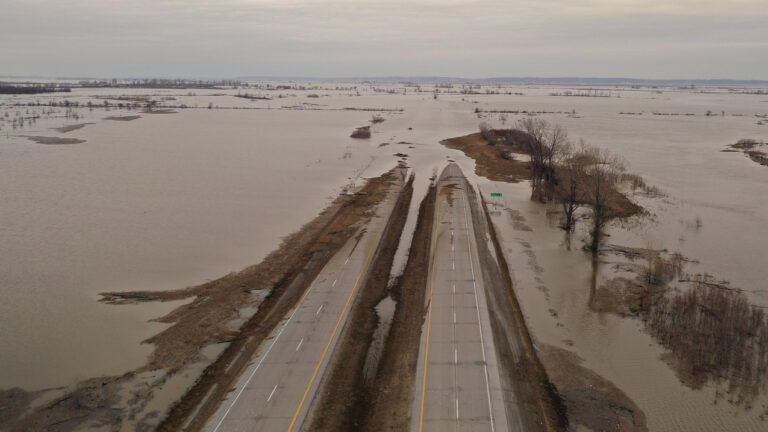
Since 2010, the Upper Missouri River Basin has experienced a series of extreme hydrological events that were not well-forecasted, including the historic floods of 2011 and 2019, as well as the equally historic flash drought of 2017. After-action reports pointed to the need for more and better observational data of soil moisture and snowpack measurements on lowland plains landscapes to improve drought and flood risk outlooks and forecasts.
“The Upper Missouri River Basin has been struck by severe flooding and drought events,” said Michael Morgan, the Assistant Secretary of Commerce for Environmental Observation and Prediction. “This program will dramatically increase the quantity and quality of soil and snowpack moisture observations in the region – fundamentally transforming our ability to understand how wet or dry this nationally significant watershed is. It will help our models – and meteorologists – identify potentially extreme weather risks earlier and pass that life-saving information on to decision makers and the public.”
Congress responded to this need by funding a set of three complementary projects in the Upper Missouri River Basin for improved monitoring, data acquisition and data application. These projects were previously authorized and directed by the Water Resources Development Act of 2020. The US Army Corps of Engineers was previously awarded US$55m to fund and install more than 500 soil moisture and snow monitoring stations in the five upper basin plains states to provide more accurate estimates of the total amount of water in the basin. These stations will collect high-quality total water monitoring data, including precipitation, wind speed and direction, solar radiation, air temperature, relative humidity, snow depth and soil moisture, also with soil characterization at each location. This will provide the most comprehensive set of data to support a wide range of applications.
NOAA’s National Weather Service National Mesonet Program – a network of weather observation networks – was awarded US$25m from the Bipartisan Infrastructure Law over three years to establish a pilot effort to acquire data from the new soil- and snow-monitoring stations and develop a system for user-friendly, public access to quality-checked data.
NIDIS was provided US$1m in Bipartisan Infrastructure Law funds over four years to organize an interagency study team to evaluate how enhanced soil moisture and snow levels data can improve water resource models, drought and flood risk assessments and other applications. This team, which will include NOAA, the USACE, the Bureau of Reclamation, the US Department of Agriculture, the US Geological Survey and NASA, will identify, fund and monitor a series of research projects targeted at various applications, such as NWS river and snow forecasts, USACE reservoir modeling and the US Drought Monitor.
These projects will seek to harness the added regional soil moisture and snowpack data to demonstrate how hundreds of additional observations can improve key drought and flood products. While the specific focus of the study is the Upper Missouri River Basin, study findings have the potential to redefine the state-of-the-art monitoring of drought and flood conditions, as well as other climate and weather applications, across the country – a priority for NOAA’s National Weather Service National Mesonet Program and the NIDIS-led National Coordinated Soil Moisture Monitoring Network.
At the end of the study period, NIDIS will synthesize the individual research projects into a summary report for Congress that will include not only the findings of the study but also how to use what was learned to improve weather and climate monitoring nationwide.
Read more of the latest rainfall updates from the meteorological technology industry, here.


