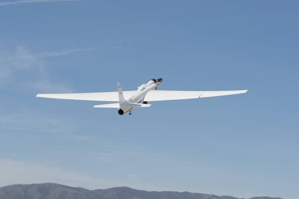
NASA has launched two aircraft equipped with meteorological sensors to collect snowstorm data from across the Midwest and Eastern USA.
The experiments are part of the second deployment of NASA’s Investigation of Microphysics and Precipitation for Atlantic Coast-Threatening Storms (IMPACTS) mission, which began in January and is planned to wrap up at the end of February.
This data will help the team relate properties of snow particles and their environment to large-scale processes – such as the structure of clouds and precipitation patterns – that can be seen with remote sensing instruments on aircraft and satellites.
One of the main goals of IMPACTS is to understand how snow bands form, why some storms are without snow bands, and how snow bands can be used to predict snowfall. To do this, the team hopes to sample a wide variety of storms throughout the three-year IMPACTS campaign.
During the 2020 IMPACTS campaign, the team sampled a variety of storms in the Midwest and East Coast, including warmer rainstorms and storms with strong cold fronts and convection. However, the team did not see a Nor’easter, a storm with a strong low-pressure system that moves up the New England coast and mixes moisture from the Atlantic Ocean with cold air from Canada.
“Nor’easters come up the East Coast and can dump several feet of snow, effectively shutting down cities,” said John Yorks, one of the deputy principal investigators for IMPACTS at NASA’s Goddard Space Flight Center in Greenbelt, Maryland. Being better able to predict where these storms will bring snow and how much could help cities better prepare for severe winter weather.
NASA and its partners have several satellites that measure precipitation from space, such as the Global Precipitation Measurement mission that observes rain and snow around most of the world every three hours. “But satellites can’t tell us a lot about the particles – the actual snowflakes – and where they form within the clouds,” said Gerry Heymsfield, one of the deputy principal investigators for IMPACTS at Goddard.
To collect the relevant data, IMPACTS is flying two aircraft outfitted with scientific instruments. The NASA Armstrong Flight Research Center’s ER-2, a high-altitude jet flying out of the Pope Army Airfield near Fayetteville, North Carolina, will fly at 65,000ft to get a top-down view from above the clouds. The instruments aboard the ER-2 are similar to those on satellites but with higher spatial resolution, additional measurement capabilities and more frequent sampling. Scientists on the ground are also measuring cloud properties from below using ground-based radars.
“A project like IMPACTS can really complement those spacecraft measurements with aircraft measurements that are higher resolution, higher accuracy, sample an event more frequently, and provide additional parameters such as Doppler measurements,” said Yorks.
The other aircraft, the P-3 Orion based out of Wallops, flies at altitudes up to 26,000ft. Probes hanging off the P-3’s wings measure the size, shape and distribution of precipitation particles. Flying the P-3 at different altitudes allows the team to measure snow particles throughout the cloud, and the temperature, water vapor, and other conditions in which they form.
The P-3 also drops small instruments, called dropsondes, over the ocean. These instruments work like weather balloons in reverse, measuring temperature, wind and humidity in the atmosphere as they fall. The team is also launching weather balloons every few hours as the storm passes overhead from several sites that move depending on which storm the team is studying. The data collected by the dropsondes and weather balloons provide information about the atmospheric conditions before, during and after the storm.
“Snowstorms are really complicated storms, and we need every piece of data – models, aircraft instruments, meteorological soundings – to really figure out what’s going on within these storms,” said Heymsfield.
The multi-year IMPACTS campaign is the first comprehensive study of snowstorms across the Eastern United States in 30 years. The science team includes researchers from NASA, several universities across the country, the National Center for Atmospheric Research, and NOAA, including partners at the National Weather Service.


