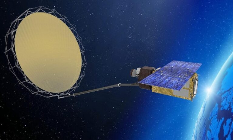
The European Space Agency (ESA) has embarked on the Copernicus Imaging Microwave Radiometer (CIMR) Level 2 Prototype and Algorithm Development (L2PAD) project, which will run from 2023 to 2027.
The CIMR L2PAD project represents a consortium of experts and organizations working in unison to develop a ground segment for the upcoming CIMR satellite, further enhancing meteorologists’ ability to monitor and understand the planet.
The primary objective of the project is the development of a Level-2 ground prototype processor for the forthcoming CIMR satellite, set for launch in the late 2020s. The prototype processor will pave the way for the scientific and operational exploitation of the data acquired by the CIMR satellite.
The CIMR mission will carry a wide-swath conically scanning multifrequency microwave radiometer to provide observations of sea-surface temperature, sea-ice concentration and sea-surface salinity. It will also observe a wide range of other sea-ice parameters. The CIMR will respond to high-priority requirements from Arctic user communities.
“The CIMR satellite will be a game-changer for monitoring the terrestrial cryosphere,” explained Dr Kari Luojus, senior research scientist at the Finnish Meteorological Institute. “Current satellite-based radiometers have a very coarse spatial resolution; the CIMR will reach a significantly higher resolution of about 5km for the frequencies applied for snow monitoring and this will benefit many vital applications such as water resource monitoring, flood forecasting and prevention. The Finnish Meteorological Institute [MET] has an extensive background in snow monitoring and will develop the algorithms applied for snow area, snow water equivalent and soil freeze/thaw monitoring from CIMR.”
The CIMR L2PAD initiative represents a fusion of research and the documentation of geophysical retrieval algorithms in Algorithm Theoretical Basis Documents (ATBDs), which will subsequently be implemented within a comprehensive Level-2 ground processor prototype (GPP). The GPP’s design and implementation will play a role in the successful execution of the project.
“A distinguishing feature of the CIMR L2PAD project is to aim at transparent and reproducible science by opening data and software as early as possible,” said Thomas Lavergne, research scientist at MET Norway. “The ATBDs will be developed as web pages based on Jupyter Book technology, and all the software will be open source. Such an open-source science approach was at the core of the work described by ESA.”
One of the challenges for the CIMR L2PAD team will be to validate the algorithms with simulated data, since the CIMR satellite is yet to be launched. The validation process aims to ensure the accuracy and reliability of the algorithms that will be deployed in the ground segment.
The scope of the CIMR L2PAD project is extensive, encompassing 20 geophysical parameters, including sea ice (across multiple variables), sea surface temperature, salinity, ocean wind, land snow, soil moisture and vegetation. Given the breadth of the endeavor, the team assembled a consortium of experts and organizations from Europe and beyond.
The consortium, led by the MET, includes 12 partners, primarily from Europe, with one Canadian partner. The consortium comprises a mix of research institutions, universities and private IT firms, such as Deimos Romania and Science & Technology Norway, to provide a rounded expertise pool.
The ESA has provided the CIMR L2PAD project with a detailed work plan containing numerous reports and milestones. The project is being overseen by a department located in the ESA Centre for Earth Observation (ESRIN) in Italy, which is responsible for developing and managing ground segments for many EO satellites, including CryoSat, SMOS, Sentinel-1, Sentinel-2, Sentinel-3, CRISTAL and CIMR.
“CIMR L2PAD will for sure be an exciting project,” concluded Lavergne. “It is also a lot of responsibility because the Copernicus users have high expectations for the CIMR mission. We are thrilled to have been selected and are looking forward to supporting the CIMR mission and its future users.”
Read more of the latest satellite updates from the meteorological technology industry here.


