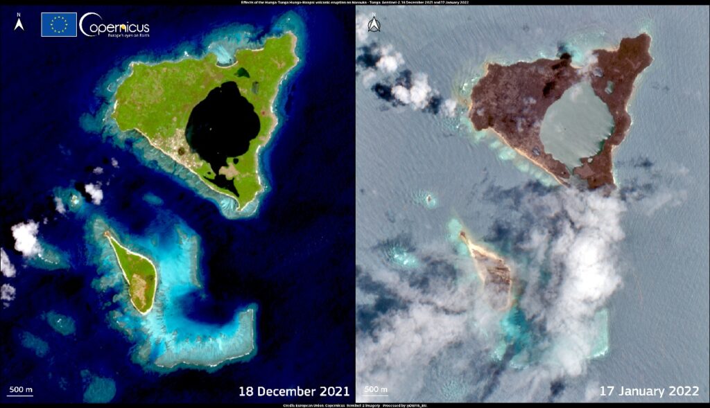
A satellite observation made by the Copernicus Marine Service (CMEMS) of a volcanic eruption and subsequent tsunami in January 2022 could provide key information in improving future volcano-tsunami-related models, possibly leading to better forecasts of when and where they may hit.
Volcano-triggered tsunamis are far rarer than those caused by earthquakes and therefore forecasting models and warning systems are less advanced.
According to CMEMS, current models did not fare well following the Hunga Tonga-Hunga Ha’apai eruption – with coastal communities in Peru and Japan experiencing unexpectedly high waves that hit early. Moreover, locations of the main wave spotted in satellite data did not quite meet predictions.
The Sea Level Thematic Assembly Centre of CMEMS, implemented by Mercator Ocean International on behalf of the European Commission, observed the volcanic eruption and seaquake of the eruption and the following tsunami via satellite observation of sea level and sea surface roughness.
Yannice Faugere, head of the satellite team and environmental monitoring department at Collecte Localisation Satellites (CLS), a subsidiary of the French Space Agency CNES and part of the CMEMS Sea Level Thematic Assembly Centre (Sea Level TAC), said, “This is the first time that we have so many flying altimeters to measure a tsunami wave. With multiple satellites monitoring the ocean, the tsunami waves have been measured several times, by several missions. These altimetry observations can be used for improving models of tsunamis, which is important for forecasting tsunamis and improving alert systems.”
The signature of the tsunami is also visible through the sea surface roughness observed by the Sentinel 1 satellite, explains Romain Husson of CLS, who is also part of the CMEMS Wave Thematic Assembly Centre (Wave TAC): “In satellite images showing sea surface roughness, we saw that the waves were curved. The curvature indicates a direction of propagation. We used Sentinel-1 information to trace the waves back to their location at the moment of the eruption. When we did this, we got to a point just a few kilometers from the center of the eruption.”
The Copernicus Marine Sea Level TAC and Wave TAC observations are complementary – while the Sea Level TAC altimetry data clearly shows the main tsunami wave, the Wave TAC backs up the Sea Level TAC observations of the tail of the tsunami. Together, the two show the power of harnessing different types of data from multiple satellites for monitoring tsunamis and improving models of how they work.


