In a new paper, scientists from five institutions have presented an anthology of key findings unearthed by satellite technology over the last two decades. The all-women group of authors includes Helen Amanda Fricker, a glaciologist and professor at Scripps Institution of Oceanography at UC San Diego.
For the past two decades, NASA has operated a series of three satellites carrying lasers – the Ice, Cloud and land Elevation Satellite (ICESat), its successor ICESat-2, and the Global Ecosystem Dynamics Investigation (GEDI) on the International Space Station – resulting in 20 years of data that have improved the understanding of Earth and how it is changing over time.
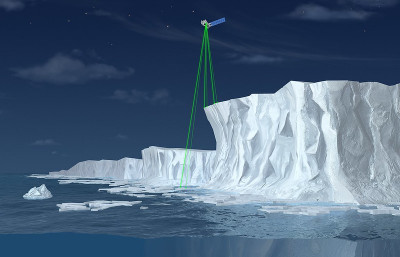
A laser altimeter is a precise tool for measuring Earth’s topography, capturing the height and shape of a specific area on Earth’s surface. A satellite shoots a laser beam from space, illuminating a certain area and then bouncing back. The height of the target area comes from how far the laser travels and how long it takes to bounce back. If there is vegetation on the surface, it estimates the canopy height and structure, as well as the ground.

The new research, published in Nature Reviews Earth & Environment, illustrates the impact of satellite laser altimetry to monitor the full Earth system. This laser technology is deployed on satellites or the space station, ensuring it remains unaffected by international borders. It collects essential data on critical Earth components such as melting ice, sea-level changes, carbon levels in forests around the globe and the amount of aerosols in the sky.
“We know from 20 years of observation that this is a great technology that can tell stories about our planet through data with unprecedented accuracy and resolution,” said Lori Magruder, an associate professor in the Cockrell School of Engineering’s Department of Aerospace Engineering and Engineering Mechanics, and the lead author of the research.
The researchers highlighted that Earth is made up of different components that work together – living things (biosphere), oceans and water on land (hydrosphere), the air around us (atmosphere), icy areas such as ice sheets and glaciers (cryosphere), and the ground beneath our feet (geosphere). Figuring out how these components interact and change with time has been crucial to working out how things might change in the future and understanding the part humans play in those changes.
NASA’s three satellite missions, two of which are ongoing, have provided global surface and canopy heights. This has enabled scientists to quantify the annual loss of 320 gigatons of land ice from Greenland and Antarctica from 2003 to 2018, representing a 14mm rise in sea level, and a 30% reduction in winter sea ice volume in the Arctic from 2003 to 2021. Outside the polar regions, water surface heights have shown that human-managed reservoirs account for 57% of Earth’s seasonal surface water storage variability, while Earth’s forests act as a net carbon sink, compensating for losses through forest growth.
“Satellite altimetry has led to so many discoveries and is vital for monitoring the health of the planet,” said Fricker. “We are living during a critical time in Earth’s history, where rapid changes are occurring due to the effects of climate change from increasing greenhouse gases in the atmosphere. Humans urgently need better ways to track and predict how Earth is changing — and satellite-based lasers provide this capability.”

NASA’s original laser altimetry mission, ICESat, ran from 2003 to 2009. Its successor, ICESat-2, launched in 2018 and remains active today. These missions are complemented by the GEDI mission, which also remains active.
For more key satellite updates from the meteorological technology industry, click here


