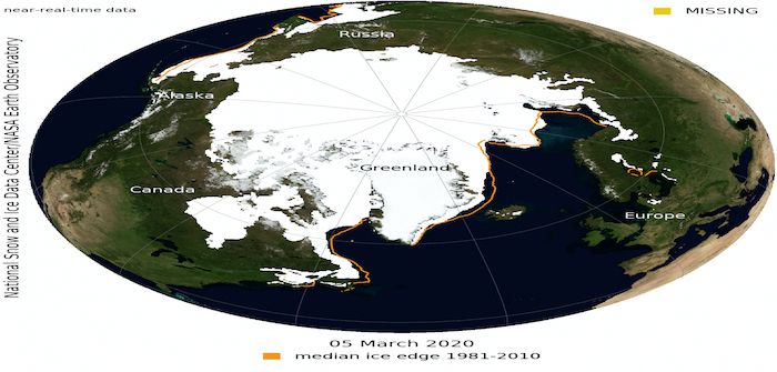
Arctic sea ice extent reached its annual maximum on March 5, covering one of the lowest ranges in 40 years.
The National Snow and Ice Data Center (NSIDC) reported that the 2019-2020 season was an unexceptional 5.81 million square miles, the 11th-lowest maximum in the 42-year satellite record.
Graphs from the NSIDC’s Charctic tool shows daily sea ice extent, and each year it follows a similar path of starting high in January, rising to the maximum between early March and mid-April before falling again until mid-September.
The 2019-2020 season was not near the bottom, but is on the lower half of the satellite record.
NSIDC reports that the 2020 maximum fell 228,000 square miles below the 1981-2010 average maximum of 6 million square miles.
The 2020 wintertime sea ice extents were closer to the long-term averages in the Barents and Bering seas.
Winter Arctic sea ice has not declined as rapidly as in the summer, it is well below the 1981-2010 average and very little sea ice survives multiple years compared with the 1980s.


