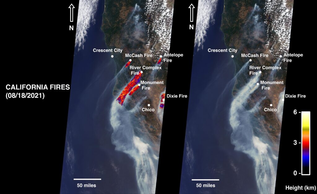
NASA’s Multi-angle Imaging SpectroRadiometer (MISR) has detected and captured giant smoke plumes originating from the recent wildfires spreading across northern California.
Fixed aboard NASA’s Terra satellite, MISR captured smoke from the McCash, Antelope, River Complex, Monument and Dixie fires, which have scorched more than 4,000km2 of land between them. The Dixie Fire, the state’s second largest in history, accounts for 2,960km2.
The MISR instrument has nine cameras that view Earth at different angles. The multi-angular information from MISR’s images is used to calculate the height of the smoke plumes.
Analysis of the imagery showed that the highest plume reached approximately 6,000m. In general, higher-altitude plumes transport smoke greater distances from the source, impacting communities downwind. In recent weeks, smoke from fires in Western USA and Canada has impacted much of the East Coast.
MISR was built and is managed by NASA’s Jet Propulsion Laboratory in Pasadena, California, for NASA’s Science Mission Directorate in Washington. The smoke plume height calculation was performed using the publicly available MISR INteractive eXplorer (MINX) software tool. The MISR Plume Height Project maintains a database of global smoke plume heights.


