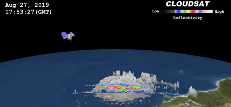
On August 27, 2019 NASA’s CloudSat satellite passed over Hurricane Dorian, still a tropical storm at the time, near Puerto Rico. CloudSat uses an advanced cloud-profiling radar that ‘slices’ through clouds giving NASA the ability to see how tall they are, where the different cloud layers are, and where the heavier bands of rain are found within the storm system. This 3D animation shows Dorian when it had maximum sustained winds of 52 mph (84 kph) with some of its cloud tops extending about nine miles (15 kilometer) into the atmosphere. The colors represent the size of water or ice droplets inside the storm — deep red and pink indicate larger droplets with areas of moderate and heavy rainfall. CloudSat is also managed by NASA’s Jet Propulsion Laboratory (JPL). The radar instrument was developed at JPL, with hardware contributions from the Canadian Space Agency. Colorado State University provides scientific leadership and science data processing and distribution.
NASA’s 3D animation shows multiple views of Hurricane Dorian from space

Previous ArticleSmart agri-tech solutions to promote innovation
Next Article Mitigating climate risk for Paraguayan crop farmers


