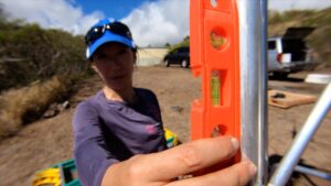
To strengthen Hawaii’s flood and wildfire early warning systems and improve the state’s response to natural disasters and the impacts of climate change, a team of researchers at the University of Hawaii at Mānoa, in partnership with the Hawaii Department of Land and Natural Resources (DLNR), is installing an advanced network of 100 weather monitoring stations across the state.
Hawaii’s latest weather monitoring stations
Each station is equipped with sensors that measure rainfall, air temperature, humidity, wind speed and direction, air pressure, solar radiation and soil conditions at multiple depths. Sensors scan every second, recording averages and statistics every five minutes. Data is transmitted every 15 minutes, ensuring real-time insights for weather forecasting, emergency management, water resource planning and more. The data captured by the Hawaiʻi Mesonet is publicly available on the UH Hawaii Climate Data Portal.
The data collected can also be used for water resource management, agriculture, ranching, ecosystem and cultural resource protection and more. The 61st weather station of the system, called Hawaiʻi Mesonet, was installed next to a Honolulu Board of Water Supply reservoir on the top of Mariner’s Ridge in Hawaiʻi Kai in December 2024. The system is already providing real-time data that is also available to the public through a web interface. Once the remaining 39 stations are deployed over the next two years, the Hawaiʻi Mesonet is expected to fill a critical gap for Hawaii.
“The network spans the whole archipelago, so we are able to get information in places that previously we had no access to,” said Ryan Longman, UH Pacific Islands Climate Adaptation Science Center consortium program director. “We can monitor and analyze weather phenomena such as extreme winds and heavy rainfall events with much more accuracy now than we had in the past. We are also using the data to create climate maps that can give us high-resolution information anywhere, and those maps are already being used by a range of stakeholders. Ranchers, resource managers and water managers are all using those maps to get information on the ground at site-specific locations, even in places where a mesonet station doesn’t exist.”
Key funding
The network requires approximately US$600,000 annually for operations, maintenance and data management. Currently, the NOAA National Mesonet Program covers 40% of the cost. The program is seeking additional state funding from the legislature for the DLNR Commission on Water Resource Management to support the UH program.
The Hawaiʻi Mesonet has secured more than US$1.5m in funding for equipment from the National Science Foundation, with additional contributions from the Honolulu Board of Water Supply and state funding to the DLNR Hawaii Commission on Water Resources Management. Installation costs are supported by WRRC and the UH Office of the Vice Provost for Research and Scholarship.
Hawaii’s resilience
The partners have highlighted that building a network like this is particularly important in Hawaii as the state’s unique landscape and climate patterns create significant variability in temperature, rainfall and other factors. For example, annual rainfall in West Maui can differ by more than 140in within one mile, requiring precise and localized data to inform decision-making.
Tom Giambelluca, project lead for the Hawaiʻi Mesonet and a long-time professor in the geography and environment department at the University of Hawaii, and former director of the UH Water Resources Research Center (WRRC), stated, “Before the project began, Hawaii was one of only 20 stations without a comprehensive statewide weather monitoring system. It’s about being able to be as prepared as possible, especially when you consider recent events like the devastating Los Angeles wildfires and the terrible Lahaina fire here at home. For instance, the system that is constantly collecting data on soil moisture can tell us in real time if an area is highly susceptible to fires or flooding. This same data collected over time can be used by farmers and ranchers.”
“The Hawaiʻi Mesonet represents a critical investment in the safety, resilience and sustainability of our island communities,” said Hawaii State Rep. Linda Ichiyama. “This advanced weather monitoring system will empower us to make informed decisions in the face of increasingly severe weather events and climate challenges like we are seeing in Los Angeles now. Supporting this initiative ensures that Hawaii is better equipped to protect our communities, manage our natural resources and plan for a more resilient future.”
In related news, the US Department of Homeland Security (DHS) Science and Technology Directorate (S&T) and US Fire Administration (USFA) recently began deploying 80 wildfire sensors and 16 wind sensors across the Hawaiian Islands. Click here to read the full story.


